

























































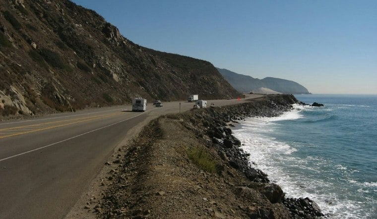
A deep fracture has opened in the coastal bluff beneath Pacific Coast Highway near El Morro, just north of Laguna Beach, and it is reportedly getting worse by the day. Caltrans has already closed one southbound lane of PCH between Irvine Cove and Reef Point Drive for emergency work, shutting down a stretch that runs alongside Crystal Cove State Park.
The damage was captured on video by surfer Blair Conklin. His video description said the situation appeared to be worsening quickly, and the New York Post reported on his footage. It shows a deep crack cutting through the cliffside below the roadway, with brown water visible beneath it. In an interview with Surfer, Conklin said the water reflects erosion tearing away at the hillside. He estimated the crack sits roughly 10 feet from the road itself and warned that a major collapse could happen within days. Separately, Sky5 footage from KTLA showed the fractured bluff beneath the roadway on Tuesday afternoon.
Caltrans District 12 has a Bolsa Chica and Crystal Cove Highway Adaptation Study, according to Caltrans.
A Coastline Already Pushed Past Its Limits
Crystal Cove State Park and San Onofre State Beach both temporarily closed sections of their grounds because of high-surf and coastal-erosion damage following Tropical Storm Rachel, per the Post's reporting. At Crystal Cove, California State Parks evacuated occupants from 26 historic 1930s-era beachfront cottages as a precaution while crews installed temporary sand-filled barriers, SFGATE reported. Cottage reservations were suspended through mid-October as inspectors assessed wave damage. Officials reported significant coastal erosion and infrastructure damage at the park.
The storm hit state park infrastructure hard elsewhere, too. At San Onofre State Beach, heavy surf from Tropical Storm Rachel exposed and snapped a water main serving Surf Beach, damaged access roads, and forced the emergency removal of a threatened restroom building, according to California State Parks. The water main break left Surf Beach without functioning restrooms or potable water.
Months of Battering Before the Bluff Finally Cracked
Laguna Beach had already declared a local state of emergency on September 10 after swells from Hurricane Marie stripped away sand and compromised seawalls, yellow-tagging six oceanfront homes along Ocean Way and Lagunita Drive, the Los Angeles Times reported. That declaration could help the city obtain assistance with sand and move sand more effectively through permitting. Less than two weeks before the PCH fracture appeared, a rockslide on September 30 destroyed a section of bluff directly beneath the Agate Street beach viewpoint in Laguna Beach, as Hoodline reported at the time, forcing crews to rope off the area while geologists evaluated what remained of the cliff. That collapse was triggered by swells from Hurricane Polo.
Nearby Dana Point saw similar devastation. City officials red-tagged seven oceanfront homes and yellow-tagged two more off Beach Road in September after heavy surf damaged decks and undermined a slab foundation, according to The Cool Down. The Cool Down quoted a Capistrano Bay District manager describing a succession of hurricanes and tropical storms since June 9 as a “freight train” and calling the situation a disaster.
El Niño and Elevated Tides Add to Coastal Concerns
Southern California is facing a convergence of forces this fall: El Niño conditions, elevated tides, a Kelvin wave, and hurricane swell, Conklin said in his video description, adding that this combination led to the destruction seen along Laguna Beach.
NOAA says El Niño continues to strengthen and expects a strong-to-very-strong event likely through January to March 2027, the Post noted.
Statewide Emergency and a Deadly Week of Surf
Governor Gavin Newsom declared a statewide state of emergency ahead of what officials are calling a potentially historic winter storm season, citing a greater than 90% probability of a very strong El Niño event. The proclamation, covered in Hoodline's earlier report on the statewide emergency declaration, authorized National Guard support and resource deployment for coastal communities. Days earlier, a man died after being rescued and receiving CPR at Dockweiler, where surf was estimated at 2 to 4 feet, as Hoodline reported.
For now, the lane closure near Crystal Cove and the sand barriers protecting the historic cottages are stopgap measures against a coastline that keeps losing ground. Whether those temporary fixes hold through future high tides, or what long-term adaptation steps Caltrans may take along the SR-1 corridor, remains to be seen.





