

























































Water flooded the Colley Avenue underpass, and a new city report says stormwater improvements proposed for two of the city's flooded underpasses could have helped the flood response.
According to The Virginian-Pilot, the storm dumped up to 6 inches of rain on parts of Norfolk in just a few hours, and underpasses across the city flooded, with some seeing nearly 7 feet of water. The Colley Avenue and 21st Street underpass also flooded.
Proposed Stormwater Improvements
Norfolk had proposed stormwater improvements for two flooded underpasses, according to the same after-action report. The report says those projects could have helped during the August storm.
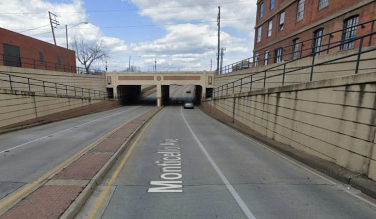
Monticello Avenue was among the underpasses affected by flooding.
Tide's Role Was Disputed
A deputy manager blamed rain and tide for the flooding, though whether tide affects underpass water levels was disputed. The Tidewater Drive underpass also flooded.
The Scope and Chrysler Hall complex saw basement and central plant flooding during the storm, though the report says it sustained no significant structural damage or long-term operational impacts.
Underpasses Are Just One Piece of a Much Bigger Fight
The underpass pump fixes sit alongside a far larger and more expensive effort: Norfolk's federally backed Coastal Storm Risk Management floodwall project, which now carries a certified cost estimate of $6.1 billion, up from the $2.6 billion estimate city officials discussed in July 2025, according to 13News Now.
A request to re-evaluate the plan is pending funding.
Norfolk City Council approved a five-year Capital Improvement Plan in August that sets aside more than $70 million for flood control and drainage work between 2027 and 2031, as reported by WAVY-TV.
Rising Tides Are Making the Math Harder
The structural challenge underneath all of this is physical, not just financial. Relative sea level at Norfolk's Sewells Point tide gauge has risen 17 inches since 1927, driven by both global ocean warming and local land subsidence, according to Wetlands Watch — a dynamic that complicates gravity-fed storm drainage across the city. NOAA projections indicate Norfolk could face 85 to 125 high-tide flood days annually by 2050, a steep climb from the 10 to 15 days recorded in 2022 and just five days back in 2000, per 13News Now.
Norfolk isn't alone in racing to catch up with the water. Neighboring Virginia Beach broke ground this month on a $127 million Thalia Creek pump station capable of moving 432,000 gallons per minute, part of a $518 million stormwater package funded a decade after Hurricane Matthew. For now, Norfolk's after-action report points to a broader challenge: stormwater improvements proposed for at least two of August's flooded underpasses could have helped.



