

























































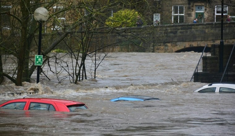
Five South Texas cities — Corpus Christi, Laredo, San Antonio, Brownsville and Kerrville — were under a flood watch through Monday morning after multiple days of rainstorms saturated the ground across the region. A level 2-of-4 flash-flood threat remained in effect across southern Texas, with forecasters warning that more rain could push already-soggy ground past its limit.
Rain Totals Already Climbing in South Texas
Some areas had already picked up more than 5 inches of rain since Sunday morning, including a stretch east of Laredo to near Kingsville, according to ABC News. Forecasters with that outlet said widespread rainfall amounts of 2 to 5 inches were likely across the cities under the watch, with some spots potentially seeing 7 to 9 inches if slower-moving or training storms set up over the same ground. Weather.com offered a somewhat different range, forecasting totals of 2 to 4 inches with isolated amounts up to 6 inches, and attributed the threat to a slow-moving upper-level disturbance capable of dumping heavy rain over a roughly 36-hour stretch.
A National Weather Service alert out of Corpus Christi, republished by KFTX, put the flood watch in place until noon CST on Sunday — wait, Monday, November 9 and described radar estimates showing a widespread swath of 4 to 8 inches of rain already fallen across the southern Rio Grande Plains and Brush Country. The same alert forecast another 1 to 3 inches through Monday evening, with isolated spots potentially topping 4 inches more. The agency cautioned that storms producing 2- to 4-inch-per-hour rainfall rates, or repeated storms training over the same saturated corridor, would create additional flooding concerns.
Rainfall Rates Could Spike Fast
Rainfall rates across southern Texas could reach 1 to 2 inches per hour during the height of Sunday's flash-flood threat, per the same ABC News account, with moderate to heavy rain expected to continue through Sunday evening and linger into Monday morning's commute. That timing raises the stakes for drivers heading to work and school in Corpus Christi and San Antonio, where roadway flooding often catches commuters off guard in low-lying areas.
Abbott Orders Rescue Teams Into Position
Gov. Greg Abbott directed the Texas Division of Emergency Management on Friday to bolster its emergency response to the flooding threat, saying the state was prepared to respond to heavy rainfall and flash floods across South and West Texas. He directed TDEM to mobilize additional state emergency response resources to support local officials and help protect Texans, and urged residents to monitor local forecasts, avoid flooded roadways and heed officials' guidance.
Among the resources made available were Texas A&M swiftwater and floodwater rescue boat squads, urban search-and-rescue teams and high-profile vehicles, according to FOX 26 Houston. The station's report also noted that boats, helicopters, medical teams and state troopers were positioned ahead of the weekend threat, giving crews a head start if roads or neighborhoods begin taking on water.
A Grim Preview From the Georgia-Tennessee Border
The South Texas threat arrived just days after catastrophic flooding tore through the Tennessee-Georgia border region, where officials reported numerous water rescues. McCaysville, Georgia, and Copperhill, Tennessee, saw catastrophic flooding after 6 to 9 inches of rain fell over several hours, sending the Ocoee River to a record 18.05 feet — well above its previous record crest of 17.8 feet set on February 16, 1990, per ABC News.
Emergency officials ordered residents of both towns to evacuate, and McCaysville Police Chief Michael Earley said at least 30 to 40 rescues had been carried out as floodwaters rose. Local 3 News reported that parts of the area received up to 11 inches of rain, destroying homes, businesses and roads. As of last Sunday, McCaysville's water system was back online, though residents were told not to drink the water and to use it only for flushing toilets.
With South Texas facing its own heavy rain and flash-flood threat into Monday, the comparison underscores how quickly saturated ground and slow-moving storm systems can turn a flood watch into a full-blown emergency. For now, the advisory covering Corpus Christi, Laredo, San Antonio, Brownsville and Kerrville remains the operative warning, and state resources are staged in case the rain outpaces the lower end of the forecasts.





