San Diego faced a dense fog advisory today morning, affecting coastal areas and inland valleys which lasted until 9 AM with visibility being reduced to less than a quarter of a mile. Information from NBC San Diego indicates that this fog was expected to last throughout the morning commute. Later that day, offshore winds cleared the sky and gusty winds were felt in the mountains.
According to the National Weather Service San Diego, by 10:15 AM, the fog and low coastal clouds had dissipated back to the coast. Meanwhile, skies to prevailed be clear further inland over valleys, mountains, and deserts.
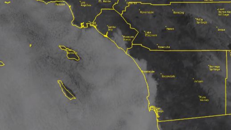
10:15 AM Wednesday coastal low cloud and fog update: The satellite loop from 9:01-9:56 AM today showed the slow burn back to the coast. Farther inland the skies were clear over the valleys, mountains and deserts. #cawx pic.twitter.com/Fr1IwMkxOe
— NWS San Diego (@NWSSanDiego) October 18, 2023
The coming days are not only expected to be warmer but some record high temperatures might be broken. NBC San Diego notes a heat advisory for inland valleys on Thursday, with temperatures estimated to reach between 95 and 100 degrees Fahrenheit. Paired with the offshore winds, these high temperatures have the possibility to break previous records in the county.
However, cooler temperatures are predicted to return over the weekend. An onshore flow is expected, and by early next week, a cold front should sweep across the county potentially bringing some showers, according to NBC San Diego.


