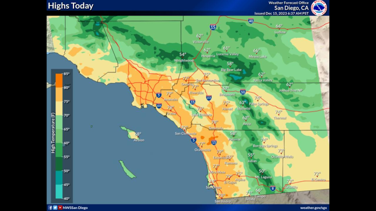
The warm streak in San Diego is expected to extend through the weekend, fueled by a persistent Santa Ana weather pattern. According to the National Weather Service San Diego CA, the region will see high temperatures ranging from the upper 70s along the coast and valleys to the low 60s in the high deserts.
Gusty Santa Ana winds today will target San Diego and Riverside County mountains and foothills. Peak gusts are estimated at 35 to 45 mph, as detailed on the NWS Forecast San Diego website. This comes after coastal and valley areas experienced highs several degrees higher on Thursday in comparison to Wednesday, verifying the power of these downslope winds.
The pleasant warmth is slated to dip slightly on Sunday, with onshore flow bringing a few degrees of cooling to coastal areas. However, "the valleys, mountains and deserts will see their warmest day of the weekend," per the reports obtained by the Area Forecast Discussion. But the serenity of the skies isn't bound to last as light showers are poised to introduce early next week, with precipitation estimations most pronounced in mountain areas.
Looking ahead, "a stronger Pacific trough will bring better chances for more significant precipitation Wednesday through Friday," according to a forecast at the Detailed Forecast page, transitioning from the dry conditions that have prevailed. An atmospheric river is to make land in Central California early next week, abandoning Southern California to lesser chances for rain. In preparation, local residents may do well to enjoy the current temperate climate before the rainfall sets its pace into a potentially wetter pattern.


