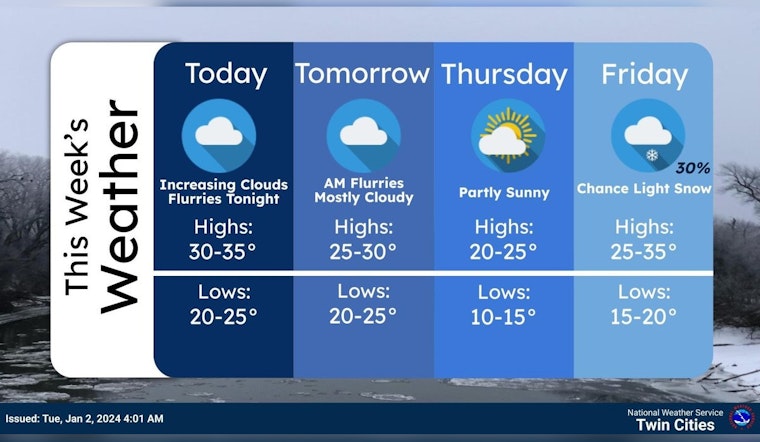
Residents of Minneapolis should brace for a chilly and flurries-speckled week ahead, according to the latest forecast from the National Weather Service. The forecast, which calls for a blend of cloudy skies and some snow, was published early this morning. The city is looking to see temperatures hovering in the mid-30s today, with a light west-northwest wind around 10 mph adding to the wintry chill.
Tonight, natives might just catch a glimpse of flurries between the early hours of 2 am and 5 am under cloudy conditions, with lows dipping to around 26 degrees. A west wind is expected to continue blowing at about 10 mph, as reported by the National Weather Service.
Wednesday promises a cloudy start, but the sun is slated to make an appearance, bringing highs near 29 degrees. It's going to get a bit brisker with a north-northwest wind reaching 10 to 15 mph. Come nighttime, partly cloudy skies will prevail, and temperatures are expected to plunge to about 15 degrees.
The rest of the week appears ready to offer a mix of sun and clouds. Thursday forecasts suggest mostly sunny skies will prevail, aiding in temperatures reaching the mid-20s despite the light and variable wind picking up a south-southwest direction later in the morning at 5 to 10 mph. By Thursday night, clouds are set to roll back in, with lows staying in the low 20s and a south-southwest wind maintaining a steady pace. And for those keeping an eye on the weekend, snow might just be back in the mix, as there's a 20 to 40 percent chance from Friday into Sunday, under mostly cloudy skies.


