San Diegans are gearing up for a weekend warm-up, with temperatures expected to reach the mid-70s along the coast and valleys, and up to around 80 degrees by Saturday, as reported by the National Weather Service San Diego. The high pressure aloft over the region is continuing to strengthen, setting the stage for a weekend with temps hovering above the seasonal average.
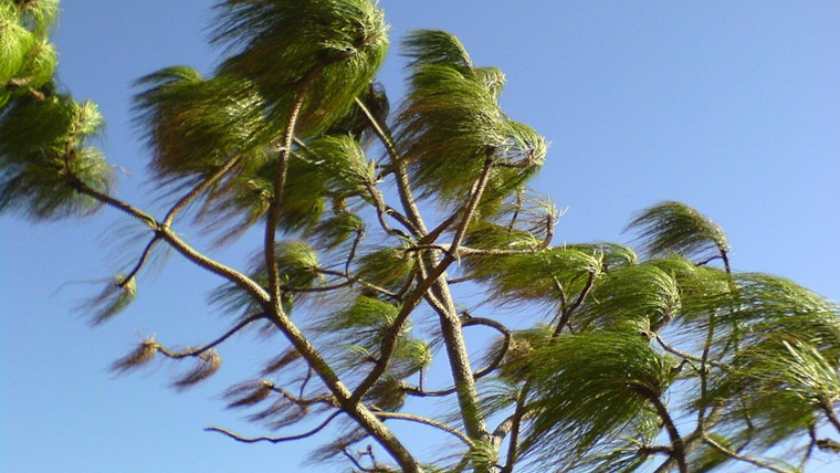
Along with the balmy weather, strong winds are on tap for the area with gusts potentially reaching 40 to 50 mph along the coastal mountain slopes, according to National Weather Service San Diego. The wind speeds might even hit the 65 mph mark in isolated areas, bringing the possibility of downed trees, and power lines. Authorities recommend securing outdoor objects and driving with caution, particularly along mountainous routes where the gusts are strongest.
For the adventurers seeking higher elevation escapes, temperatures in the mountains are forecast to be mostly in the 50s, with lower desert areas enjoying warmer climes in the 70s. But the high temperatures and strong winds aren't the only story; a significant change is looming on the horizon. "A wetter pattern is expected to develop around Thursday of next week and continue into the following week," the National Weather Service San Diego predicts.
Local beachgoers should note the elevated surf conditions, with a high tide just under 6 feet stirring up surf as high as 6 feet, which could lead to minor tidal overflow in San Diego County during the morning hours. While there are no hazardous marine conditions anticipated through Tuesday, mariners are always urged to remain vigilant while at sea.
The incoming weather shift not only promises a respite from the dry conditions but also brings the potential for rainfall totals that could exceed 5 inches in parts of the region next week. The wetter pattern marks a stark turn from the tranquil and sunny setting currently gracing the San Diego area, so residents should prepare for a return to winter wetness after enjoying the weekend warmth.


