Detroit's upcoming week looks to present a shifting palette of early spring weather. The National Weather Service is forecasting varying skies over Detroit, with temperatures ranging from brisk mid-30s to mildly warm highs touching the mid-50s. Settling into an ever-changing dance, sun, and clouds will alternate their hold across the days, nudging Detroiters to keep both sunglasses and scarves within reach.
Today holds the promise of a gradual clear-up, as "mostly cloudy" skies are expected to give way to a sunnier afternoon with a peak at 54°F. North winds will cruise at about 9 mph, according to a report from the National Weather Service. Tonight, the wind's chilling breath slows down, whispering at just 6 mph from the north-northeast, while partly cloudy conditions will hover overhead and temperatures will dip to a low of around 36°F.
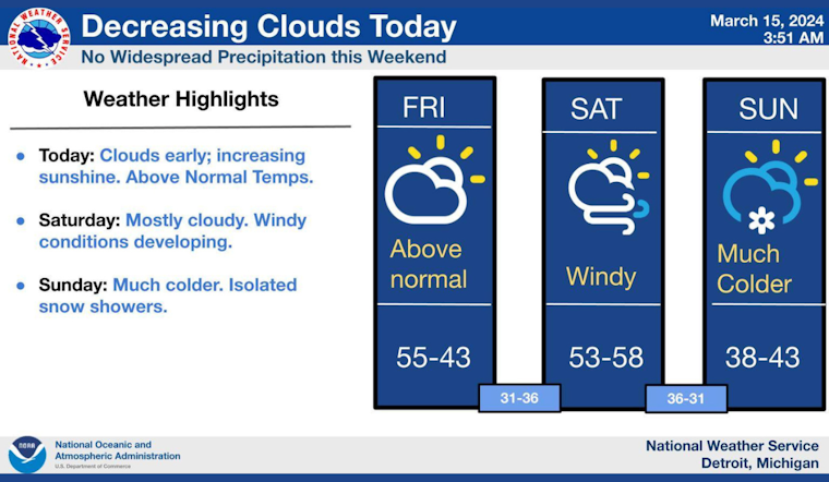
Looking ahead to the weekend, Saturday will have Detroit residents bracing against a blustery south-southwest wind with its strength gaining from 9 to an assertive 14 mph, eventually boasting gusts potentially knocking on the door of 32 mph. The temperature is expected to climb to a mild 58°F under partly sunny skies.
Providing some resistance to Saturday's powerful gusts, the west wind will stiffen up to 10 to 16 mph Saturday night, albeit with lesser might, as gusts are forecast to reach up to 24 mph, while temperatures are predicted to drop to around 36. "Partly sunny" phrases Sunday's forecast, with the wind remaining steadfast from the west. The high will take a slight dip near 45°F, blowing strong with potential gusts nearing 23 mph.
As the new week begins, Detroiters will experience relatively steady conditions with "partly sunny" skies on Monday and highs taking a plunge near 38°F. The clouds will seem to think better of leaving altogether, showcasing "mostly cloudy" nights with lows snuggling close to the freezing mark on both Monday and Tuesday nights.
The NWS outlines an expected temperature turnaround come Wednesday, with the sun standing firmly in the sky, as the city looks to enjoy a high around a soothing 48°F. Wednesday night will mimic the prior nights with "partly cloudy" conditions and similar lows in the ballpark of 30°F.
The forecast for the remainder of the week continues the pattern of generally pleasant if not slightly cool temperatures for this time of year. The high should hover around 47°F beneath "mostly sunny" skies on Thursday. Keep abreast of the changing conditions at the National Weather Service website.


