The Big Apple's southern cousin, San Diego, is seeing a shift in weather patterns, according to recent reports from the National Weather Service San Diego CA (NWS). With the merciful departure of a low-pressure system, San Diegans can expect a warm-up today and into Saturday, with temperatures hanging around the seasonal average or just a tad below. NWS Forecast Office San Diego, CA reported that lower elevations are due for a temperature boost of around 5 degrees compared to Thursday, while folks in the mountains can feel up to 10 to 15 degrees more warmth.
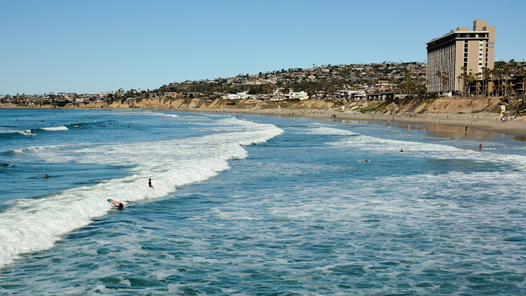
Surf's somewhat up! This weekend, beachgoers might still catch some swells with wave heights hitting 6 feet this morning before simmering down in the afternoon. As described by the Area Forecast Discussion from NWS San Diego, "Elevated surf to 6 feet will continue through this morning, generating strong rip currents." However, winds and seas are expected to mellow out, bringing combined seas below 9 ft.
While San Diego’s coast and valleys experience slightly cool air on Sunday, the warmth is not taking a day off in the mountains and deserts where temperatures will climb a degree or two. After the weekend, the NWS warns of an approaching pair of low-pressure systems that will start cooling off Monday and Tuesday, reducing high temps by around 5 degrees from weekend highs. This cooling trend is short-lived, though, as Wednesday is set to bring the heat back to near-average highs.
The weather outlook gets a bit windier towards the end of next week. The potential development of a low-pressure system could stir up the atmosphere, giving rise to "gusty northeast winds with the strength ranging from weak to strong depending on the uncertain placement of the low pressure system," as forecasted by the NWS. The strongest winds are expected on Thursday, with the Area Forecast Discussion noting that "the highest uncalibrated wind speed from any ensemble member [is] to 61 mph."
Sky conditions over the region will vary, with scattered to broken clouds dissipating by Friday afternoon, creating mostly clear skies that will last into the night. This is good news for pilots as the NWS aviation forecasts predict "unrestricted visibility except where clouds and terrain intersect," allowing for smooth flights over the southern California skies.


.jpg)