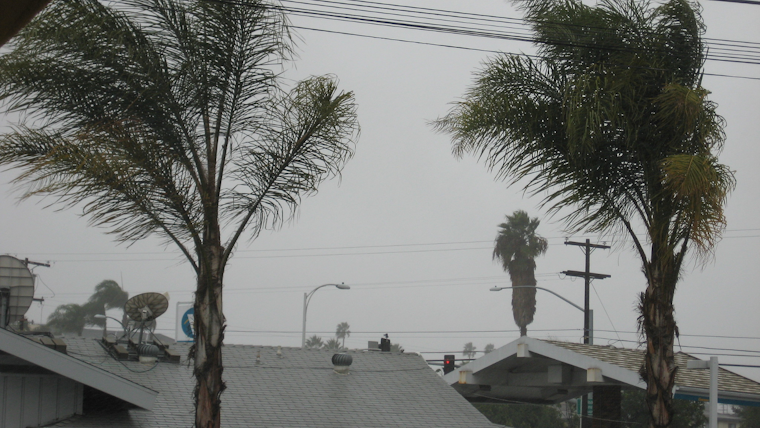
Southern California is bracing for a mixed bag of weather this week, with forecasts indicating everything from light rain to strong, potentially damaging winds. According to the National Weather Service San Diego, residents witnessed scattered light showers early Tuesday, mainly across San Diego County, while gusty west winds picked up in the afternoon and evening, gusting up to 60 mph in isolated spots. These winds are predicted to weaken by Wednesday, giving way to warmer and calmer conditions.
Thursday, however, is expected to deliver a stout blast of northerly Santa Ana winds that could prove to be disruptive. The early forecast points to the possibility of gusts reaching up to 95 mph near coastal foothills of the Santa Ana Mountains and near Cajon Pass. In a statement obtained by National Weather Service San Diego, it was advised that the strongest of these winds will most likely hit around sunrise Thursday. A High Wind Watch has been put in place late Wednesday night through Thursday afternoon for several counties including Orange, San Bernardino, and Riverside, as well as the Inland Empire.
Temperatures are also experiencing a modest roller coaster ride with inland areas cooling down on Thursday before a closed low-pressure system swings chances for showers and slight chances for afternoon thunderstorms from Thursday night into Saturday. "There is also a slight chance for thunderstorms for those areas, mainly Friday afternoon and again Saturday afternoon during peak daytime heating," according to the Area Forecast Discussion on the National Weather Service website.
In preparation for the Santa Ana winds, the NWS has issued advisories and is urging local communities to stay alert. "The current guidance supports a potentially damaging wind event for Orange County and for areas near and below the Cajon Pass," the National Weather Service disclosed. On the marine side, boaters should also take caution as the outer coastal waters will experience west-northwest wind gusts reaching 20-25 knots, particularly near and south of San Clemente Island which could create hazardous conditions. A Small Craft Advisory is in place through early Wednesday for affected regions.
As the weekend approaches, the weather is forecasted to settle down somewhat. By Monday, the NWS anticipates conditions will dry out and warm up with temperatures in the region to to notably rise above average levels. Residents and visitors alike are encouraged to monitor updates and stay prepared for the weather challenges that this week will bring.


