Houstonians brace yourselves for some stormy weather ahead. According to the National Weather Service, the city could see showers and thunderstorms today, with a 40 percent chance of rain after 1 p.m. and a high near 80 degrees. The skies will stay gloomy tonight with showers and thunderstorms likely before 4 a.m., and an east southeast wind changing to north as the temperature drops to around 58 degrees.
While Houston gets its dose of rain, a severe weather outbreak is poised to take aim at parts of the central and southern Great Plains. "There is an enhanced risk of severe thunderstorms from the eastern TX Panhandle and western OK into southwest/south-central KS," the NWS Storm Prediction Center warned. Scattered severe thunderstorms predicted for late Thursday could unleash very large hail, severe wind gusts, and even a couple of strong tornadoes.
The week is looking a bit choppy, weather-wise, with a 30 percent chance of showers and thunderstorms early Sunday morning, but the clouds are expected to part by Sunday night. Moving into Monday and Tuesday, Houstonians can expect sunnier days with highs of 73 and 79 degrees, respectively, as per the NWS forecast.
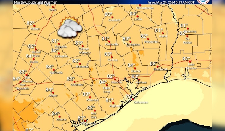
In a post from NWS Houston, they confirmed the warm trend saying "The warm-up continues today with afternoon high temperatures rising into the low to mid 80s for much of the region." Yet, the brewing storms beyond the city suggest that a serene scene in Houston today could belie the chaotic weather to come. As the week progresses, residents should keep an eye on the forecast and stay prepared for potential changes.
Good morning SE Texas!
— NWS Houston (@NWSHouston) April 24, 2024
The warm-up continues today with afternoon high temperatures rising into the low to mid 80s for much of the region. #HOUwx #TXwx pic.twitter.com/imkDjjhrrn


