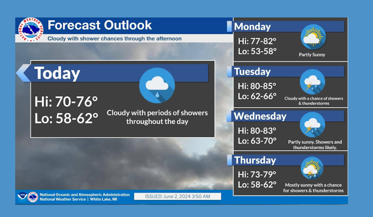
Detroit residents, brace yourselves for a week of soaking showers and rumbles of thunder as the city prepares to face a mixed bag of weather conditions. According to the National Weather Service, there's a fair chance that today could get loud and wet in the afternoon hours with the possibility of thunderstorms and showers occurring after 2 pm. The high is expected to hover around a balmy 76 degrees, and an east-southeast wind will gently sweep across the city at about 7 mph. The service predicts that the chance of precipitation is 60%, with new rainfall potential staying under a tenth of an inch, although this could increase during thunderstorms.
The night ahead is slated to remain mostly cloudy but will cool down to a comfortable 59 degrees, with the east wind slowing to a calm pace by evening. The outlook for Monday promises a break from the wet weather with mostly sunny skies and a high climbing near 81 degrees. Calm winds are anticipated to gain some strength, shifting east-southeast at 5 to 7 mph as the morning progresses.
However, the reprieve will be short-lived. By Tuesday, the chance of rainfall is set to return in the form of intermittent showers between 8 am and 2 pm, escalating to possible thunderstorms in the latter part of the day. The overcast skies will nonetheless allow temperatures to soar to a hot 86 degrees, driven by a south wind traveling at 6 to 10 mph, according to the weather forecast. Precipitation probabilities linger around 40% for both the day and the following night, maintaining the possibility of more showers and thunderstorms.
Wednesday brings a 90% certainty of wet conditions, with likely showers then escalating to a thunderstorm after 2 pm, maintaining high temperatures in the lower 80s. Transitioning into the evening, showers and possible thunderstorms may persist until midnight, before giving way to a chance of showers post-2 am amid a partly cloudy sky and a dip in the temperature to 63 degrees. The rhythm of shower chances and partial sunshine continues through to the weekend, with daytime highs settling comfortably in the mid-70s.
For those residing or working 4 miles south of Hamtramck, MI, the point forecast reflects similar conditions with latitude 42.33°N and longitude 83.04°W, at an elevation of 571 ft. The comprehensive weekly weather conditions for the Detroit area have been updated as of 4:24 am EDT on June 2, 2024, with the forecast remaining valid through 6 pm EDT on June 8, 2024.


