Residents of Las Vegas and surrounding his area should be prepared for a mix of weather conditions as monsoonal moisture brings thunderstorms and potential flash floods today and Thursday. According to the National Weather Service, the region will experience increased humidity, which will amplify the oppressive heat sensation. Although HeatRisk values have not consistently reached Major-to-Extreme levels, an Excessive Heat Warning has been extended through the evening to account for the compounded effect of the high humidity on individuals spending significant time outdoors.
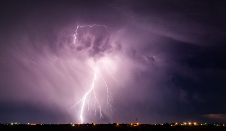
Shifting meteorological dynamics will see the monsoon's moist influence wield thunderstorms across the landscape, initiating over higher elevations by late morning before descending into the valleys later in the day. The southern zones, bathed in precipitable water values ranging from 1.25" to 1.75", stand vigilant against the persistent risk of flash flooding, particularly under stronger storm cells. "PWATs across the Mojave Desert range from 1.25" to 1.75", meaning the risk of flash flooding underneath strong or training storms persists across our southern zones," the National Weather Service report stated. Concurrently, temperatures will hover 5 to 8 degrees above the seasonal norm, exacerbating the humid heat's embrace.
Aviation bulletins advise pilots and passengers alike, forecasting storm formation around airport peripheries, with a 40 percent likelihood of thunderstorms later implicating flight paths through the Las Vegas Valley. "Showers and thunderstorms will initially form on higher terrain across the forecast area around 18Z before moving into valley locations through the afternoon and evening," cautioned the National Weather Service. Erratic gusts from nearby thunderstorm activity could affect flight operations; otherwise, standard wind patterns are expected to prevail. Ceilings generally remaining at or above 15 kft may drop to at or above 10 kft in the vicinity of storm activity.
The weekend and subsequent days bring significant change; a Pacific Northwest-originated trough will displace the monsoonal high pressure, enabling a reduction in humidity and the restoration of temperatures closer to average. However, the glimpse of respite is fleeting as another surge of high pressure looms for next week, poised to resume the conditions akin to those experienced earlier in the summer—an atmospheric cycle renewing its hold upon the region.


