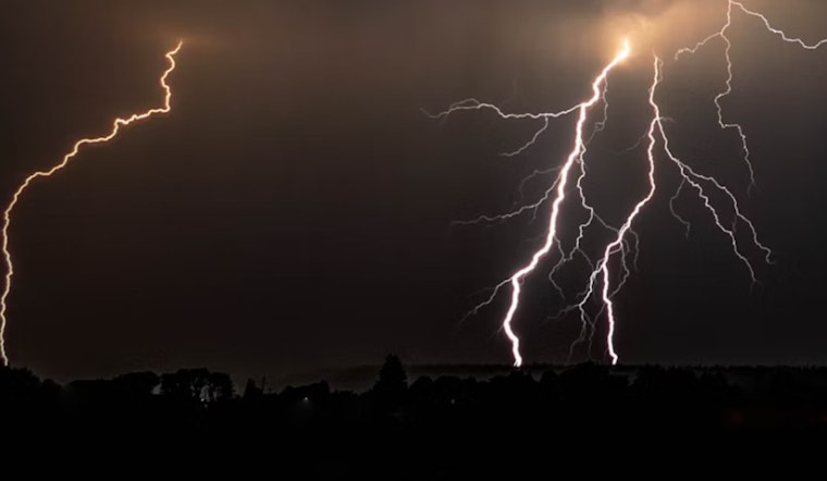
Las Vegas and its surrounding regions brace themselves as the National Weather Service in Las Vegas reveals an increase in thunderstorm activity, along with persistently high temperatures heading into the weekend. According to the National Weather Service, today's weather is influenced by the spread of monsoonal moisture westward, causing greater chances of strong wind gusts and heavy rainfall, particularly in Clark and Mohave Counties.
The shift in the weather pattern is a result of a change in the flow aloft, which is now more southerly on the western fringe of the Four Corners high. This change is forecast to not only escalate thunderstorm coverage but also to introduce hot temperatures across the region that are going to significantly remain above normal. Moreover, the National Weather Service has upgraded an Excessive Heat Watch to a Warning for a sizeable swath of the area due to the high certainty of the impending scorching conditions.
For aviation, the scenario poses a challenging forecast this afternoon with the initiation of showers and thunderstorms within the valley that are likely to generate gusty outflow winds. "Initially, outflow winds look to approach from the south, then afterwards outflow winds could potentially come from any direction," the National Weather Service predicts. Post-sunset, the thunderstorm activity is expected to diminish, and winds are anticipated to return to a lighter, more consistent pattern.
In terms of the long-term outlook, temperatures are only expected to climb as a high-pressure system bolsters and slowly encroaches westward, creating a hazard for those especially within the Colorado River Valley and Mohave County. Into next week, the upper-level ridge is prepared to hold its position, trapping moisture and preserving the possibility for afternoon and early evening thunderstorms. Uncertainty in the forecast, however, starts around Tuesday due to ambiguities regarding the interaction between our ridge and an incoming shortwave trough.
Spotter activation may become necessary for parts of the region, and the National Weather Service encourages spotters to report any weather or impacts that are deemed significant. Real-time updates and safety advisories will be important in coming days as the area navigates these potentially volatile weather conditions.


