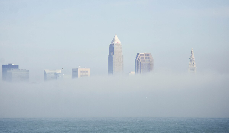
The quiet ripple of a summer's day in Cleveland was slightly disturbed by dense fog this morning, as the National Weather Service Cleveland OH advised caution for travelers encountering poor visibility in several areas such as Erie, Lorain, and Cuyahoga, among others. The fog was particularly intense in low valleys and higher hills, reducing visibility to as low as one-quarter of a mile, with conditions expected to improve as the day progresses. Use extra caution if you're out on the roads early.
Looking beyond today, the forecast shows no significant hazards. However, isolated to scattered showers and storms could pop up on Monday and Tuesday, where a few storms might crank up the intensity, possibly unleashing damaging winds or large hail, according to the Hazardous Weather Outlook issued by NWS early this morning, which stated that "Spotter activation is not expected at this time."
As August heat sets in, today's highs will soar to about 86 degrees with a light northwest breeze, shifting southerly as dusk nears. Looking ahead, Monday takes a steamy turn coupled with a 30% chance of rain and possible thunderstorms, mainly rolling in after 4 p.m. As the sky grows heavy with clouds, the temperature may drop to a low of around 69 degrees on Monday night.
Come Tuesday, bring your umbrellas as the likelihood of showers ramps up to 60%. Potentially, a thunderstorm might visit after 8 a.m., accompanied by new rainfall amounts between a quarter and half an inch. Weather buffs will be happy for the sunny reprieve expected by midweek, promising clearer skies and a high near 77 on Wednesday.


.jpg)