Las Vegas and the surrounding areas are preparing for a range of weather conditions. In western Nevada, residents can anticipate dry and breezy weather today. Meanwhile, Mohave and Lincoln counties might experience isolated to scattered thunderstorms. Looking ahead, drier air moving in on Monday and Tuesday will lead to rising temperatures and limit thunderstorms primarily to eastern Mohave County, according to the latest forecast from the National Weather Service.
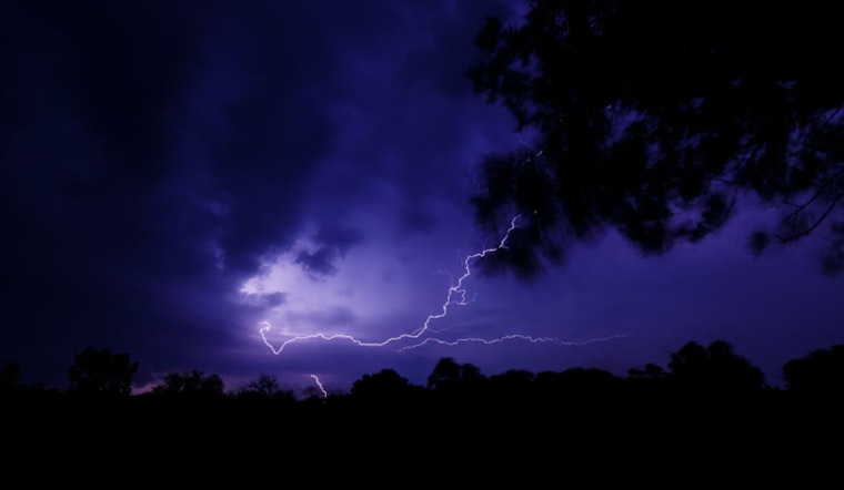
The Red Flag Warning for Esmeralda and Nye counties stands strong, with critical fire conditions anticipated due to the combination of gusty winds and dry air, and although these heightened winds are projected to subside slightly on Monday, the risk remains significant. Areas farther east will experience moister conditions and a small respite from the stronger winds that are sweeping the region, the outflow of which was clearly depicted in the latest midnight satellite loop of National Weather Service.
Focusing on aviation, gusty south to southwest winds are forecasted to affect the Harry Reid International Airport with isolated afternoon thunderstorms projected to be restrained to the Peach Springs corridor. The broader regions of southern Nevada, northwest Arizona, and southeast California will similarly experience an increase in south-southeast winds transitioning to gusty south-southwest winds in the afternoon.
As we look towards the midweek outlook, the potential for moist conditions to return is on the radar with predictions of an inverted trough inching its way into the region; however, this humidity is anticipated to be a fleeting phenomenon with a Pacific trough expected to deliver drier, cooler air and drive temperatures below late-August norms as we head into the weekend. This eclectic weather pattern has prompted National Weather Service to alert spotters to be vigilant and ready to report any significant weather or impacts as they unfold.
Overall, the southeast half of the region may continue to see at or above-normal temperatures as the northwest half cools down, but the shifting systems suggest the entire area may anticipate anomalously windy conditions, potentially increasing fire dangers due to the anticipated drier airmass, according to National Weather Service. These breezy conditions exacerbate fire weather concerns, especially when wildfires are already a pressing issue for communities.


