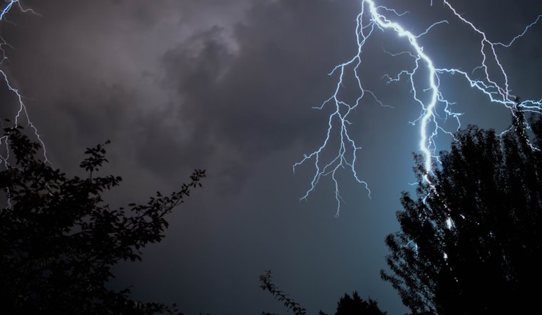
Las Vegas residents can expect another bout of thunderstorms today due to persistent monsoonal moisture, according to the National Weather Service. However, it appears the weather will soon take a turn, as drier air is set to bring this current monsoon episode to a close by midweek, with a return to more comfortable temperatures for the area.
In the early hours of this morning, the skies were partly cloudy as the last showers and thunderstorms moved out of Lincoln County around 1 am. While storm motion will be quicker today, reducing the threat of flash flooding, there's still a "30% probability of >1" in 3-Hour QPF over far northeast Mohave County, as reported by the National Weather Service Las Vegas. Furthermore, stronger storms might emerge across Clark County and the Mojave National Preserve due to greater instability and divergence aloft.
This weather situation is bound to change tomorrow, as it's expected that storms will be mostly confined to northwest Arizona. The incoming drier air will not only signal the end of active monsoon weather but also bring about a rise in south to southwest breezes, particularly in areas like Inyo, Esmeralda, and Nye Counties, where there are elevated concerns for wildfires; meanwhile, Las Vegas and Death Valley National Park are set to enjoy more palatable overnight lows.
Looking ahead to the end of the week, the forecast suggests "amplification in a trough off the west coast with the high pressure center displaced slightly further east over New Mexico/Texas," according to NWS. Such positioning could mean a modest resurgence of monsoon moisture, mainly affecting northwest Arizona and potentially reaching parts of southeast Nevada and the eastern Mojave Desert of southern California. For those west of the trough, expect drier and breezier conditions, with temperatures hovering around the normal range.
Aviation-wise, airports like Harry Reid are seeing overnight winds from the south at around 10 knots, gusting up to 18 knots, with the day's storms forecasted to stay largely east of a Primm to Boulder City line. Pilots should anticipate generally light morning winds that will pick up later in the day. In southeast California, southern Nevada, and northwest Arizona, the drier air moving in from the west is limiting the possibility of thunderstorms primarily to areas along and southeast of Interstate 15.


