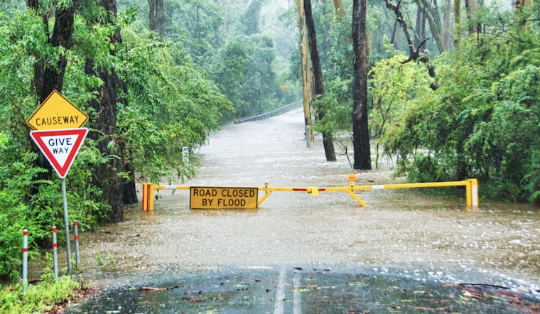
Residents in the Charlotte Metro area woke up to continued inclement weather Tuesday morning, as the National Weather Service (NWS) issued several advisories warning of potential flash flooding. A Flood Watch remains in effect until 8 AM EDT, urging residents in the Piedmont region of North Carolina to be cautious, as excessive rainfall could lead to flooding, particularly in low-lying and flood-prone areas. According to the NWS, parts of Mecklenburg County could receive rainfall totals between 2 and 4 inches, with locally higher amounts of 4 to 5 inches possible.
The NWS forecast detailed the presence of a weak area of low pressure continuing to push inland across the Carolinas, subsequently an upsurge in rainfall totals. The advisory highlighted that the excess runoff from heavy rains could swell rivers, creeks, and streams, setting the stage for potential flood conditions. Residents have been urged to monitor the situation, and to be prepared to take action quickly should Flash Flood Warnings be issued.
In addition to the Flood Watch, a Flood Advisory also remains in force, reflecting ongoing concerns about "minor flooding in low-lying and poor drainage areas." Commuters early this morning faced visibility reduction due to patchy fog and persistent rainfall, with a 40 percent chance of showers carrying over into the night.
The NWS, detailed that runoff from heavy rainfall continued to work through the watersheds of greater Charlotte early this morning, with nuisance flooding expected to subside gradually as the day progresses.
Looking ahead, the likelihood of showers and even thunderstorms persists throughout the week, with Wednesday anticipating a 30 percent chance of precipitation. Relief seems probable by the weekend, with sunny conditions and high temperatures hovering in the lower 80s forecasted for Friday and Saturday. While the immediate hazard revolves around the ongoing Flood Watch, no further hazardous weather is expected Wednesday through Monday.


