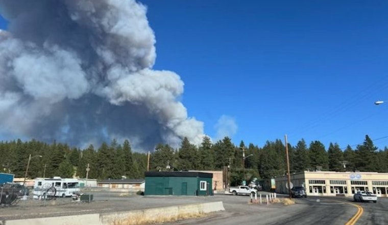
High winds have exacerbated the Copperfield Fire near Klamath Falls, Oregon, prompting Level 3 evacuation orders and growing concerns among residents. KGW reports that the blaze, which began Sunday, has now consumed approximately 3,241 acres as of Monday evening. The rapid spread of flames has led to stark warnings east of Chiloquin, with residents north of Klamath Falls being advised to evacuate immediately.
As of Tuesday morning, road closures remained enforced for the, now 3,656-acre, fire which has expanded swiftly due to strong winds the previous afternoon. In response, Oregon Governor Tina Kotek has enacted the Emergency Conflagration Act, and the Oregon Department of Forestry’s Incident Management Team 3 has been mobilized. This action was reported by the Statesman Journal, as statewide efforts ramped up to control the devastating wildfire.
An evacuation center is currently open at the Chiloquin Community Center for those going west; however, evacuees heading east are directed toward the Klamath Falls Fairgrounds. "The crews worked overnight and were able to get dozers line around the heel of the fire and up the east and west flanks. Today, they are working to get a dozer line around the north side of the fire to connect those lines, also to stop the forward progression of the fire," said a spokesperson in a statement obtained by Central Oregon Daily News. Coordination and resources are flowing in, with the Oregon State Fire Marshal's Red Incident Management Team and eight task forces responding to the emergency.
The challenge posed by the Copperfield Fire is not the mere containment by dozer lines but the potential for wind-blown embers to cross these barriers into adjacent dry grasses. "Dozer lines are pretty solid. It’s more with that wind coming in, if embers go across the dozer line into the dry grass on the other side, that’s where the problems occur," highlighted a firefighting official in an interview with Central Oregon Daily News. The Sprague River Highway remains closed from mile markers 5 to 15, impacting travel east of Chiloquin. The Klamath County Sheriff’s Office is the point of contact for the latest evacuation and shelter information.


