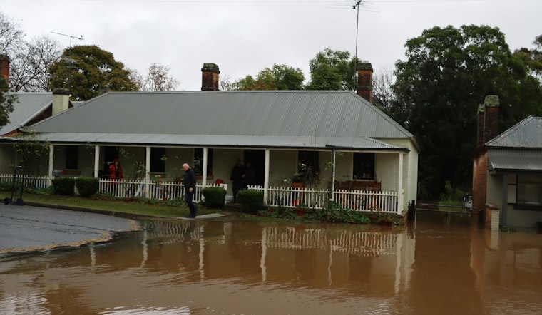
The National Weather Service in Oklahoma City has issued a Flood Watch effective from this morning through Monday afternoon across multiple counties in Oklahoma and parts of northern Texas. As per the weather report, heavy rain is expected to cause excessive runoff, potentially leading to flooding. Residents in these areas are being advised to stay alert and prepared for flooding conditions.
Forecasts suggest "several rounds of showers and thunderstorms are expected from Saturday through Monday," with areas set to see rainfall totals between 3 and 7 inches. It's noted by NWS that some regions could experience even higher amounts. With the ground already saturated and the rivers full, the risk of flooding is pronounced, affecting both urban and rural locations. After issuing the flood watch, areas like Oklahoma City, Norman, and Moore, may expect poor drainage and urban areas to be particularly vulnerable.
The watch includes a comprehensive list of counties in both states indicating a broad area of potential impact, such as Oklahoma, Cleveland, Logan, and other areas. The specified region suggests a serious threat to personal property and infrastructure, with the NWS warning that the flooding "may occur in poor drainage and urban areas." Local officials are likely to monitor the situation closely and could issue further guidance in response to the changing conditions.
According to the detailed forecast, the chance of precipitation stands at a steady 100% for nights and the upcoming Monday, hinting that those in the watch areas should be cautious. The watch's language underscores the seriousness of the situation, with terms like "excessive rainfall" and "flooding caused by excessive rainfall continues to be possible." The statement also notes that the intense rainfall may lead to rivers, creeks, streams, and low-lying areas being overwhelmed. Preparedness actions have been suggested by the NWS, including monitoring upcoming forecasts and being ready to act if flood warnings are put into effect.


