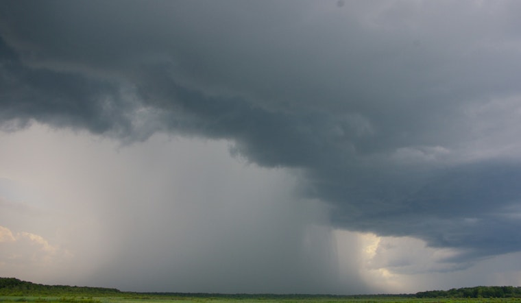
The islands of Hawaii are bracing for a combination of weather conditions this week, starting with a trough and plume of tropical moisture that's currently causing heavy rainfall and thunderstorms across some areas. According to the National Weather Service (NWS) in Honolulu, the Big Island and Maui have been placed under a Flood Watch through this afternoon, with the possibility of the watch being canceled earlier for Maui as the main threat of heavy rain shifts westward towards Oahu and Kauai.
Yesterday's heavy downpour on the Big Island resulted in rainfall rates up to 3 inches per hour and totals in the range of 8 to 12+ inches. Hawaii County Civil Defense was forced to close multiple roads due to localized flash flooding. The NWS reports anticipate the threat of rain to generally downswing on the Big Island as conditions begin to improve. Nevertheless, people are urged to remain cautious and to watch for updated weather alerts. Moderate to breezy trade winds are expected to slightly weaken today ahead of a cold front scheduled to arrive by tomorrow, which is projected to partly restore the windy conditions later in the week.
Ahead of the approaching cold front, the NWS forecasts a resurgence in trade winds across the islands, leading to breezy to locally windy conditions by tomorrow night and continuing into the weekend. This patterning also suggests that clouds and showers will favor windward and mauka areas, potentially increasing local showers. As the weekend approaches, forecast models begin to show some divergence, with the current outlook keeping a wet and windy pattern into the early part of next week.
Boaters should prepare for stronger northeast winds and rising seas, set to reach Small Craft Advisory levels by Thursday, around 10 feet due to a mix of local winds and north to north-northwest swells. Surfers can expect north and west-facing shores to experience lower surf through midweek before conditions pick up once again tomorrow night going into the weekend. An active pattern over the northern Pacific is set to bring additional medium-period swells, with the first possibly arriving Sunday night into Monday. Next week's forecast indicates more swells, with north and west-facing shores potentially seeing surf near advisory levels or higher.
Residents and visitors alike should remain vigilant as the weather continues to evolve. The Flood Watch for areas such as Maui Windward West, Haleakala Summit, Kona, and Big Island Interior, among others, serves as a reminder of the potential for severe weather and its associated impacts. As always, staying informed and prepared is the best way to ensure safety during such volatile weather conditions.


