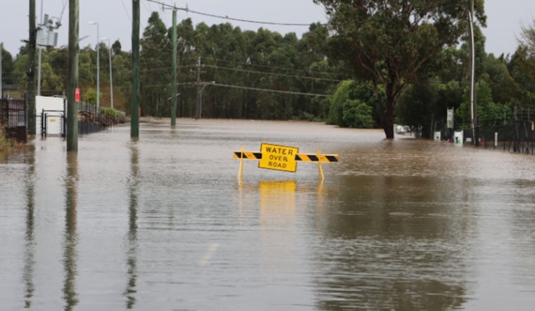
The National Weather Service in New Orleans has issued a coastal flood advisory for southeast Louisiana and southern Mississippi. Minor coastal flooding is expected from this evening through early Monday, with water levels potentially rising up to one foot above normal, according to the National Weather Service.
Issued early this Sunday morning, the advisory comes as the National Weather Service projects an onset from 6 PM this evening, stretched into 6 AM CST Monday. Key areas, including St. John the Baptist, St. Charles, and Lower Terrebonne, are expected to experience the most minor flooding from this advisory. As the advisory warns, "Flooding of lots, parks, and roads with only isolated road closures expected," residents should brace for possible disruptions and heed all precautionary directives.
New Orleans is expecting significant weather changes this week. Monday's forecast calls for showers that could turn into thunderstorms by night, with a high chance of heavy rain, especially on Tuesday. This could lead to flooding, and "some roads may be closed." Authorities recommend avoiding travel unless necessary and allowing extra time for commutes. The National Weather Service advises, "Take the necessary actions to protect flood-prone property." After the storm, the weather is expected to clear, with cooler temperatures and sunny skies returning by the weekend.


