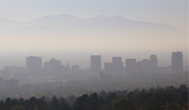
The National Weather Service in Salt Lake City has issued a weather update for the region, reporting widespread haze and patchy fog. Conditions are expected to continue into the coming week, with varying levels of visibility. As of the last update on December 4th at 7:05 AM MST, the temperature was noted at 28°F (-2°C), with humidity levels reaching 86%. The wind remains calm, rarely stirring the settled haze, as reported by the National Weather Service.
Today's forecast, according to the National Weather Service, includes widespread haze and some fog before 11 am, giving way to sunny conditions and a high near 47 degrees. The clarity of night will be marred only by the continued presence of haze, with low temperatures falling around 29 degrees. Similar weather patterns are expected to persist through the week, with calm winds doing little to disperse the haze.
As the weekend approaches, the haze is poised to remain an unwavering companion to Salt Lake City residents. However, a shift in weather is anticipated by Sunday, with the NWS forecasting a chance of rain and snow, casting a potentially cleansing palette upon the persistent smog. The high is expected to linger near 44 degrees, with a slight chance of rain and snow extending into the night.
The start of next week could bring some respite from the hazy blanket, with Monday offering a slight chance of snow and partly sunny skies, and highs predicted to drop to nearly 37 degrees. The night may bring chillier air, with lows hovering around 20 degrees. By Tuesday, the city should experience mostly sunny conditions, with high temperatures clawing back up to around 36 degrees. Respite from the haze, while on the horizon, remains an arm's length away for now.


