Salt Lake City residents woke up to a chilly mix of rain and snow this morning, but the wintry mix is expected to make way for clearer skies later in the day. The NWS predicts a chance of rain between 8 am and 2 pm followed by gradual clearing with a high near 46 degrees. As the winds shift to the northwest in the afternoon, the day's earlier dampness should dissipate, giving way to a dry and slightly warmer evening, according to the National Weather Service.
Those planning evening activities might take comfort in the forecast as a "partly cloudy" sky tonight will pave the way for a low of around 30 degrees. The calm conditions at night, becoming east-southeast around 5 mph after midnight, promise a blanket of tranquility ahead of the latter half of the week. As per the NWS, the rest of the week looks to bring a gentle reprieve from the early week's inclement weather, with "mostly sunny" conditions leading up to the weekend.
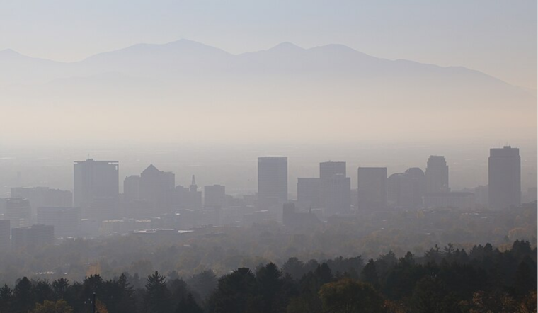
However, clearer skies don't mean clear air, with the NWS foreseeing "widespread haze" starting Friday. Daytime temperatures are expected to hover around the 50-degree mark, providing residents a mild backdrop for their pre-holiday engagements. Despite the haze, the absence of significant precipitation suggests outdoor plans can proceed with minimal weather-induced disruption.
For those looking ahead, the weekend's "widespread haze" is predicted to persist, with Saturday temperatures peaking near 51 degrees and nightfall bringing "mostly cloudy" conditions along with a low around 34 degrees. While Sunday will be "partly sunny" with a high again near 49, those entering the new workweek might want to pack an umbrella as a "slight chance of rain" is on the NWS's radar for Monday.


