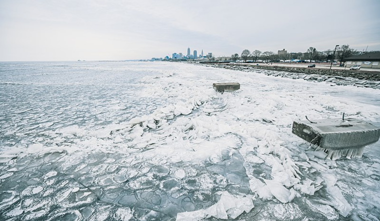
As Cleveland braces for a mix of wintry weather, the National Weather Service (NWS) has issued a detailed forecast for the coming days. According to an Area Forecast Discussion from the NWS, the region will experience high and low-pressure systems that shape weather patterns, including snow and possibly hazardous travel conditions.
The near-term forecast, remaining unchanged from earlier updates, expects scattered lake effect snow showers to continue, mainly east of Cleveland. "There are no changes needed with the near-term forecast at this time," the NWS states, indicating that winter weather advisories are in effect for areas expected to be hit by lake-effect snow. High pressure is anticipated to build in later today, with temperatures struggling to rise out of the upper teens and low 20s. Higher winds could result in chill values near or just below zero in the morning.
Heading into Thursday, the situation evolves as a clipper system is set to bring widespread light snow across the Cleveland area. "We are expecting a general light snowfall of 1 to 3 inches across the area by tomorrow afternoon," the NWS explained. This light snowfall could affect morning and evening commutes with potentially slippery road conditions. Meanwhile, temperatures are forecast to be slightly warmer, making it into the upper 20s to around 30 degrees.
The pattern remains active into the weekend. On Friday, Cleveland will see a low surface drifting across Hudson Bay, and a ridge will build north over the area, providing a short-lived reprieve before another trough brings more precipitation. Models predict "confidence is high that widespread showers will move across the area Saturday, the biggest uncertainty is which form of precipitation it will fall as," the NWS reports. The weather shift will start with rain, transitioning to a rain/snow mix, and then to all snow as cold fronts pass through the region. "This will likely result in additional headlines needed or current ones extended," the service mentioned as the weather intensifies.
Marine conditions also reflect the turbulent weather, with a Small Craft Advisory in effect for parts of Lake Erie until Friday. Due to persistent waves and wind speeds, the advisory extends from Willowick to Ripley, NY. "Given the wind directions and persistent wave heights of 4-6 feet, Willowick to Ripley NY remains in a Small Craft Advisory until 10 AM Friday," per the NWS's marine forecast.
The long-term outlook into next week suggests that a deepening upper-level trough could usher in even colder conditions. There's potential for sub-zero temperatures and dangerous wind chill values nearing -20F, especially by Monday night. "These temperatures will pose a threat to anyone not prepared or to those that have to spend any prolonged period outside," the NWS warns, emphasizing the importance of staying updated with the latest forecasts as this weather unfolds.


.jpg)