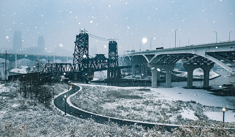
As Cleveland braces for a winter wallop, the National Weather Service (NWS) advises residents to prepare for an extended cold snap and significant lake-effect snowfall. The synoptic drama unfolds as a low-pressure system and associated cold front traverse the region, inviting a cold high to settle over Cleveland for the weekend. According to the National Weather Service's Area Forecast Discussion, areas downwind of Lake Erie will experience snow accumulations so significant that Winter Storm Watches have been hoisted from Friday morning through Sunday morning for a melee of counties, with Lake Effect Snow Warnings stretching beyond the weekend in Northwest Pennsylvania.
Commuters looking to sneak in their morning drives between snowflakes might find solace in the brief moments of clarity that are marred by the forecasted snow squalls. While roads may intermittently clear, NWS warns of "light synoptic low" conditions that could potentially turn any surface into a wintry slide, playing hazard to the "limited" morning commute on Friday.
It's the lake-effect snow that's the headline grabber, though. Keeping Clevelanders on their toes, the snow showers are expected to intensify Friday, with "a combination of increasing low-level instability (lake to 850mb temperature differentials of 15-18C), rising inversion heights (lake-induced equilibrium levels of 9-11k feet), deep synoptic moisture, and instability and lift maximizing near or in the dendritic growth zone" per NWS forecasts. These atmospheric shenanigans are projected to yield squall lines that can clock in at 1 to 2 inches per hour, veiling the city in a white layer that can be awe-inspiring for its beauty and daunting for those tasked with its removal.
The weekend doesn't promise much respite, either. The "classic multi-banded lake effect snow setup" is expected to deliver a varied feast of fluffy accumulation across the region, transitioning from west-northwest flow conditions on Friday evening into more westerly ones as Saturday wears on. In a move that could have snow enthusiasts relishing the conditions, local peaks in the snowbelt could see sums that challenge the one-foot mark, guaranteeing blankets of snow that would make a yeti feel at home.
As the new week dawns, things won't warm up much. A low-pressure system takes a southern detour but could still swipe at Cleveland, leaving behind enough snow to warrant scraping the boots off come Monday morning. "Colder than average temperatures persist behind this system through midweek with some lake effect snow," adds the National Weather Service, meaning that residents might want to keep those winter gears at the ready a bit longer.
On the aquatic front, mariners face their slew of warnings, with Small Craft Advisories in effect and the NWS forecasting "brisk westerly flow" continuing through Sunday morning. Not one to favor the land-dwellers alone, the cold snap also promises potential ice growth in the western basin, an icy cherry atop this frosty week's offerings.


.jpg)