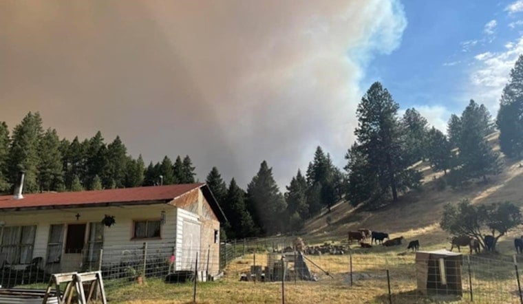
In a significant step to aid in the aftermath of the 2024 Summer Fire Season, Oregon has been granted a federal disaster declaration, marked by the identifier FEMA-4854-DR-OR, facilitating a much-needed stream of federal support flowing into Gilliam, Grant, Umatilla, Wasco, and Wheeler counties, a move that was bolstered by the state's use of StoryMaps to illustrate the dire situation, as reported by the official State of Oregon's website.
The underpinnings of securing such federal support lie in the details, and StoryMaps translated the scrupulous response data into an approachable narrative complete with interactive elements that described the challenges faced by the community and the conflagration's scope and scale, the State of Oregon's disaster declaration request process was significantly enhanced through this storytelling approach, showcasing in stark detail the event through the prism of real-time data on the ground conditions, power disruptions, and infrastructure damage, it was this approach that acted as cornerstones for making a solid case for the federal assistance needed for the recovery in these hard-hit regions.
Digging deeper into the 2024 Wildfire StoryMap reveals an assortment of elements that paint a comprehensive portrait of the disaster, providing insights into how local and Tribal communities grappled with the fires, including but not limited to data on evacuations faced and the intricate recovery challenges which followed, according to the Oregon Emergency Management (OEM).
Integral to the narrative that secured federal aid was the governor's letter, which laid out the dire need for support, but it was the StoryMaps with their clickable maps and embedded videos, that truly made the plight of Oregon's communities palpable for federal partners, including FEMA, ushering in an unprecedented level of transparency and engagement, decisions makers were provided with an easily digestible format of the data that underlined the state's struggle against these fires this was underscored by Daniel Stoelb, a GIS Program Coordinator, who told the official State of Oregon's website, "Using StoryMaps for the disaster declaration process provides our community and decision makers with information in an easy-to-read and understandable format."
Beyond serving as support for disaster declarations, these StoryMaps are designed to serve a broader purpose, ensuring that the public and partner organizations get a clear and complete overview of the disaster's impacts and the collaborative efforts during the crisis, including those of emergency services and the community at large, which can be explored further by anyone interested through the Oregon Disaster Storymaps Collection.
As Oregon presses on with its recovery, these StoryMaps remain an essential communicative bridge, sharing not just data but relaying stories of resilience, courage, and the human spirit, aiding in the continuity of efforts and solidarity among all, a reminder of the need for clear, data-backed discourse in the times of recovery.


