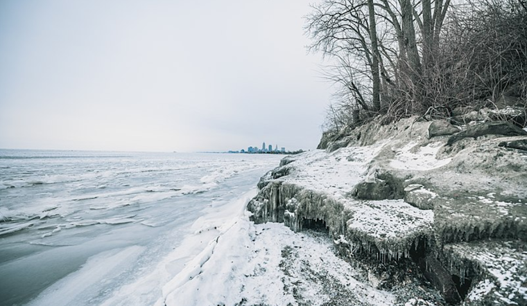
Cleveland residents are bracing for a biting cold snap as Arctic high pressure settles into the region. According to the National Weather Service in Cleveland, the area is to expect frigid temperatures to persist into midweek, with an upper-level low expected to sweep through the Great Lakes region. The cold snap comes on the heels of winter weather that necessitated advisories, which have since expired, although snow showers are predicted to continue throughout the day.
Despite the mercury struggling to reach the 20s and lows dipping into the single digits, no additional major winter weather warnings have been issued for the near term. The National Weather Service forecast indicates that "pretty much all locations should stay under 20F this afternoon, or very close to it," with easing winds tonight, followed by "temperatures bottoming out under some clearing." Tuesday is slated to be the coldest day on the horizon, with high temperatures only managing to claw into the low to mid-teens.
This weather pattern is part of an Arctic air mass that the National Weather Service reports will maintain much below normal temperatures through the short term. Precipitation isn't off the table, with the upper-level trough and a surface low-pressure system potentially bringing snow showers from Wednesday into Thursday. The silver lining is that conditions should improve heading into the weekend, with diminishing snow showers expected by Thursday evening.
On a brighter note, the outlook for Friday through Sunday suggests a dry spell as high pressure dominates the eastern U.S. Flexing its influence, this high pressure is to gradually coax temperatures upward; northeastern Ohio can look forward to climbing back into the 30s by Sunday. Travelers keeping a wary eye on the skies should take some comfort, as conditions are set to slowly return to something resembling normal after the passing of this Arctic interloper.
The forecast also spells out the implications for air travelers and mariners. Snow showers may lead to flight category reductions throughout the day, and light snow with scattered lake-effect snow showers could persist into Thursday night, potentially impacting visibility. Lake Erie mariners should now cautiously navigate due to strong westerly winds and the advisement of ice floes, with the assurance that winds are expected to weaken as high pressure builds.


.jpg)