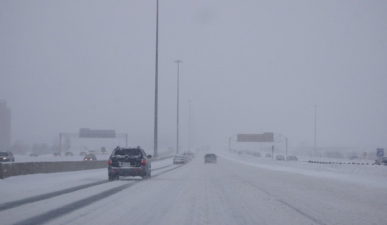
Residents across East Arkansas, Southeast Missouri, and West Tennessee are bracing for a mix of wintry conditions as the National Weather Service (NWS) in Memphis issues a Winter Storm Warning effective from noon today until noon tomorrow. The NWS advises that heavy mixed precipitation—comprising snow accumulations between 1 and 6 inches alongside a light glaze of ice—is expected across the region.
The NWS warns that these conditions could lead to slippery roads, likely affecting both Tuesday evening's and Wednesday morning's commutes; residents are urged to plan accordingly and be prepared for challenging travel circumstances, especially since the highest snow totals are anticipated along and north of the Interstate 40 corridor, with lesser amounts expected to the south. All those venturing out should carry essentials such as an extra flashlight, food, and water in their vehicles in case of emergencies and stay informed on the latest road conditions by calling 511.
In addition to the snow, the NWS has also conveyed concerns about potential flooding along the Mississippi River, particularly impacting areas in Mississippi, Arkansas, and Tennessee—this includes Tunica Mhoon Landing and the city of Memphis itself; a Flood Advisory has been issued from this evening to Sunday, March 2, signaling that riverine areas may see an uptick in water levels and localized flooding.
Those living near the Mississippi River are advised to monitor rising levels. At 29.0 feet in Arkansas, the evacuation route from camps south of Hopefield Chute is cut off, and water is lapping at the levee near Sulcer Road west of South Lake, indicating the seriousness of the situation. Additionally, the river is touching the levee at Blue Lake, according to the NWS's latest bulletin. For context, as of 7:00 PM CST yesterday, the river stage was noted at 24.4 feet and is forecasted to crest at 29.5 feet by Monday, February 24. With this in play, caution and acute awareness of water levels are advised for all residents in the advisory areas.
Stay up to date on these developments by checking in with reliable sources, such as the official NWS Memphis page for the latest weather reports and safety guidelines during this time of inclement weather and potential flooding. As conditions progress, citizens in the affected regions will need to remain vigilant and heed any evacuation orders or travel advisories issued by local authorities. For more detailed information and updates on the weather and flood advisories, you can always refer to weather.gov/memphis for timely and accurate guidance.


