Denver is bracing for a mix of weather conditions over the next week, with forecasts of rain, snow, and subsequently mild temperatures. According to the National Weather Service, the city will experience a 40 percent chance of rain today, mainly after 3 pm, turning to snow as the evening progresses. Additionally, there is a 70 percent chance of precipitation tonight, with potential new snow accumulation of less than half an inch.
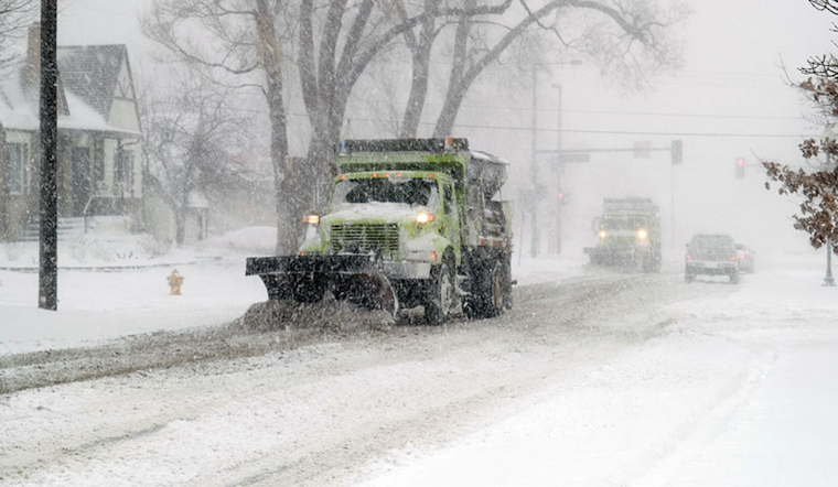
The hazardous weather outlook for northeast and north central Colorado indicates an onset of widespread snow in the mountains later in the day. It is expected to turn to rain across the plains, and by midnight, conditions are predicted to be cold enough to transform the rain into snow. Most of the precipitation shifts onto the far northeast plains late tonight. While there may be up to 5 inches of snow accumulation in the mountains, the plains are expected to receive little to no snow accumulation through tonight, apart from the far northeast corner which could see up to 2 inches by sunrise on Friday.
For Friday, the NWS forecast predicts snow continuing throughout the day and into the night. Areas over the Front Range mountains and foothills, especially the southern foothills, should prepare for 2-5 inches of snow, while less than an inch is forecasted for the majority of the plains. Travel conditions will be poor Friday afternoon and especially Friday night in the higher terrain. This serves as a precaution for travelers to be conscious of the changing road conditions as the snowfall intensifies.
Looking ahead, Denver residents can expect a shift toward milder weather conditions starting Sunday through Tuesday. The forecast promises a sunny Sunday with a high near 65, followed by even warmer temperatures reaching up to 71 on Monday. Very mild temperatures are expected to define the early parts of next week, creating a notable contrast to the chilly and snowy conditions experienced toward the end of this week.


