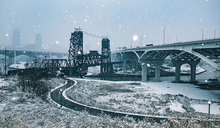
According to the latest updates from the National Weather Service (NWS) in Cleveland, Cleveland residents can expect a classic springtime roller coaster of weather this week. Monday ushered in a strong cold front accompanied by snow showers, wind, and a notable temperature drop. But don't pack away those lighter jackets just yet – seasonable conditions are on the horizon.
A brief period of high pressure is touted to bring some much-desired calm on Tuesday, but only after we've seen the last fleeting snow. The NWS notes that "deepening surface low pressure in response to an upper-level trough axis" is the culprit behind today's tumultuous weather. High winds and a sudden hike in temperatures to potentially 50 degrees Fahrenheit were predicted prior to the front's arrival, though these numbers will take a dive in its wake. Forecasters noted, "Temperatures well below freezing tonight in the 20s, recovering to low 40s for the western CWA Tuesday afternoon."
Looking ahead to the midweek spell, Wednesday night won't afford us any respite as another low-pressure system is set to bring precipitation until Thursday night. NWS Cleveland assures, "The bulk of precipitation should be rainfall," but the initial onset could include snow showers due to the low dew points. They also warned, "This may lead to additional rises in rivers and localized flooding given the recent, very wet conditions across the area." It's a mixed bag, with the region caught between the throes of winter's final grip and the burgeoning whispers of spring.
For those eager for brighter skies, the weekend forecast seems more promising. The NWS forecast discussion anticipates a shift toward drier conditions as a high-pressure system nudges in. Come Sunday, temperatures are expected to reach "into the mid 50s to low 60s." But don't plan your picnics just yet; marine life isn't quite out of the woods – or the water. The NWS has flagged the need for a Small Craft Advisory on Lake Erie through Tuesday afternoon, citing "waves building to 5-7 feet, with locally higher possible."
Updates on this dynamic weather pattern can be tracked on the NWS Cleveland website as the service closely monitors the evolving conditions. Before you step out, it's advisable to check the latest forecast and plan accordingly, be it bundling up or breaking out the rain boots.


.jpg)