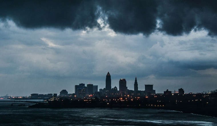
The forecast for Northeast Ohio looks wet, with the National Weather Service in Cleveland predicting a soggy situation as an upper-level low pressure system moves into the area. According to NWS Cleveland, light rain showers that started early this morning are set to spread across the region throughout the day. While thunderstorms are expected, they are anticipated to stay below severe levels.
Not just a drizzle, but the potential for heavy rainfall looms over residents. Forecast soundings suggest a "long, skinny CAPE with generally slow storm motion." This, coupled with PWATs well above the 90th percentile compared to sounding climatology from ILN and PBZ, has put most of the forecast area in a Marginal Risk for Excessive Rainfall in their Day 1 Outlook. With highs today peaking in the upper 60s to lower 70s, and low temperatures settling near 60 degrees tonight, it seems like residents might want to keep their rain gear at hand.
Conditions won't let up on Wednesday as the slow-moving system continues to dictate the weather, eventually transitioning into an upper-level trough that sticks around through Thursday. As reported by NWS Cleveland, Wednesday temperatures are expected to hover in the low 70s across the board. Meanwhile, as we head into the latter part of the week, eyes are fixed on a cold front approaching late Thursday that could bring strong to possibly severe convection, particularly as it nears the I-75 corridor and northwest Ohio that evening.
Though there may be a brief respite from the rain on Friday, don't expect the reprieve to last. Temperatures on Friday will likely not see much change, with high temperatures still ranging from the upper 70s to middle 80s. However, yet another shortwave is predicted to sweep over the Great Lakes region late Friday into the night, likely reintroducing showers and thunderstorms to the area. This could mean a damp start to the weekend, with the Weather Service advising that a cold front is anticipated on Saturday morning and may necessitate Small Craft Advisory headlines through to Saturday.
With aviation and marine activities also expected to be impacted, it's a week when keeping an eye on the weather isn't just advisable—it's essential. From shower-engulfed tarmacs to churning lake waters, those in Northern Ohio and its adjacent bodies are in for a tempestuous week indeed. For the latest on flight or sail conditions, it's best to stay updated via local weather reports and alerts.


.jpg)