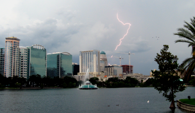
The National Weather Service in Melbourne, FL, has alerted residents across the Orlando area to brace for a series of weather events, which include a broken band of showers and lightning storms with a coverage between 60-70%, heralding the approach of a late-season "cool" front. Impacts expected from the storms include gusty winds of up to 60 mph, small hail, and the potential for brief urban flooding due to stronger storm cells.
According to the area forecast discussion released by the National Weather Service, the cool front will bring a temporary dip in humidity across the I-4 corridor, even as seasonably warm conditions persist into the following week. However, in a twist of meteorological defiance, the front stalls over Southern Florida come Sunday, concentrating rain and storm chances mainly around the Treasure Coast and southern Space Coast as the weekend rolls on.
Continuing weather trends are expected to persist into next week, characterized by a marginal risk of severe storms, including potentially vigorous mid-level troughs that may influence local patterns. The forecast above anticipates that moisture return northward could be key to another active day, especially afternoon-evening lightning storms, as the front's lingering effects and ongoing atmospheric interactions provide a stage for localized heavy rainfall, particularly across parts further south of the Orlando metro.
Boaters along Florida's coastline, from Volusia to the Treasure Coast, should exercise added caution, as storms moving offshore pose hazards such as gusty winds and lightning strikes. The front's passage will result in slackening winds today, setting the tone for a week where E/SE winds become the norm. For mariners, this implies initial seas of 2-4 ft subsiding to 1-2 ft by Sunday night and on into the early parts of next week.
Aviators aren't left out of Mother Nature's itinerary, with bands of storms impacting Orlando's airspace early Saturday morning. As per aviation updates, a 20-30% chance of wind gusts 35+ KT may punctuate the Greater Orlando skies through around 13Z, while late morning and midday travelers through the Treasure Coast would have to contend with similar conditions.
On land, the weather service has flagged a potential for briefly drier conditions north and west of I-4 on Sunday, which could affect local fire weather conditions. Aside from that slight reprieve, the forecast remains busy with scattered (occasionally numerous) coverage of lightning storms well into the early part of next week. For Orlando and its environs, the coming days are a reminder of the atmospheric forces at play and the capriciousness of Florida's weather patterns.


