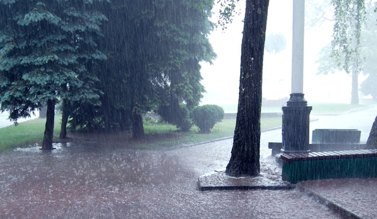
As Memphis residents gear up for a potentially stormy week ahead, the National Weather Service (NWS) in Memphis has released detailed forecasts, emphasizing a mix of thunderstorms and fair weather patterns. According to the NWS Memphis forecast, today brings a 60% chance of precipitation, with showers and possible thunderstorms expected mostly between 1pm and 4pm. Temperatures are set to hit highs near 90 degrees, with conditions only slightly cooling to a low around 73 tonight, where the chance of precipitation drops to 50%.
Tomorrow ramps up the storm potential, with an 80% possibility of showers and possibly a thunderstorm starting as early as 7am, the temperatures peaking at a high near 86. The forecast holds relatively steady into the evening, with rainfall amounts of three quarters to one inch possible, indicating significant precipitation. However, clarity seesaws with incoming storms, as residents will experience a mostly cloudy night, with a steady southwest wind around 5 mph. As Sunday rolls in, the probability of rain decreases, leaving only a 30 percent chance of showers and thunderstorms mainly before the early afternoon.
Looking forward to next week, the NWS forecasts a consistent pattern of showers and thunderstorms leading into Monday, maintaining a 60% chance of precipitation throughout the day. The weather eases into mostly cloudy nights with lows around 67 degrees by Monday evening. Yet, the break seems momentary, as Tuesday again brings mostly sunny skies, with expected highs climbing to near 84.
The latter part of the week presents varied possibilities, with Wednesday showing partly sunny conditions and a high near 86, diverging into a mostly cloudy evening. The weather plays a delicate balance between sun and storm, as Thursday's forecast suggests a 40 percent chance of showers and thunderstorms amidst a landscape of clouds, with highs lingering near the mid-80s.


