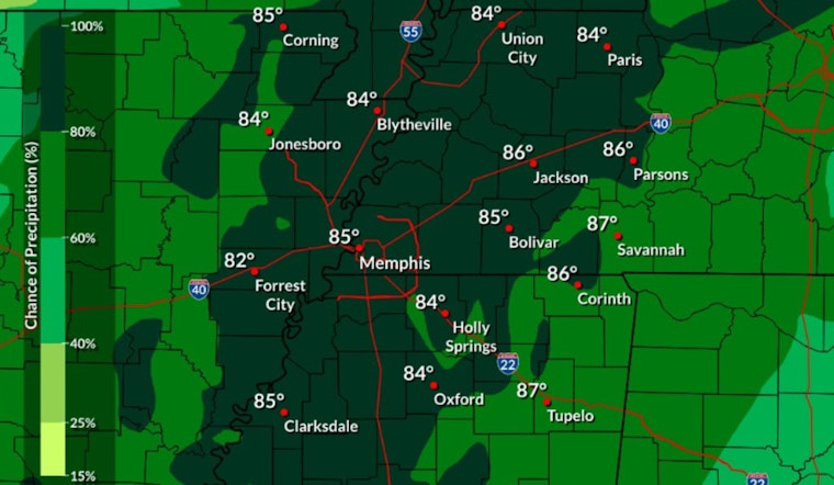
The National Weather Service in Memphis has updated its weather forecast for the upcoming week, and the city should prepare to navigate a mix of thunderstorms and high temperatures. According to the National Weather Service, today will bring an 80 percent chance of showers and thunderstorms, potentially disrupting the morning commute. The NWS predicts new rainfall could range from a tenth to a quarter of an inch, with higher amounts possible during thunderstorms.
This forecast is stuck on repeat... most of this rain will move in late this afternoon and continue into the evening. Organized severe weather is not expected, but any storms that form could produce gusty winds and locally heavy rainfall. ⛈️ pic.twitter.com/5frARYvWnz
— NWS Memphis (@NWSMemphis) June 16, 2025
Showers and thunderstorms will likely persist through Monday night, mainly before midnight, with up to half an inch of new rainfall possible. On Tuesday, there's a 40% chance of lingering showers and storms, but skies should gradually clear as the day goes on, as detailed by the National Weather Service.
As the week moves forward, temperatures are slated to rise with Wednesday's highs approaching 92 degrees and winds coming from the south southwest at 10 to 15 mph. A slight reprieve may come in the form of a 50 percent chance of showers and thunderstorms Wednesday night, making the air a tad more bearable.
Looking ahead to Juneteenth, those celebrating the holiday might have to plan for intermittent rainfall. The NWS forecasts a 50 percent chance of showers and thunderstorms with a high near 88. The latter part of the week appears to show signs of calming, with only a 20 percent chance of showers predicted for Friday after 1 pm, leading up to a sunny weekend with highs cresting near 95 degrees.


