As Southern California braces for a mix of weather conditions, the National Weather Service in San Diego has forecasted a slight chance of showers and thunderstorms this afternoon for the San Bernardino Mountains and adjacent high desert areas. "A deep marine layer will continue into Friday morning with patchy night and morning drizzle," according to the National Weather Service. The weather pattern suggests a shallow marine layer with less coastal cloud spread over the weekend and a gradual warming trend for the region's mountains and deserts into early next week.
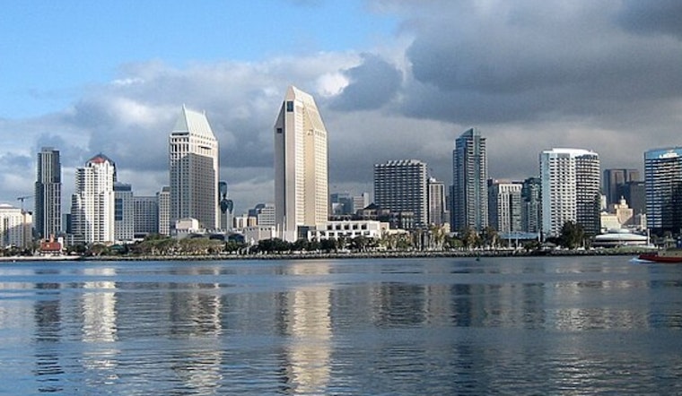
The marine layer, currently at about 3500 feet, has brought drizzle primarily to the coast and valleys of San Diego County and parts of southern Orange County since Wednesday evening. The steady deep marine layer will remain into Friday morning, limiting afternoon clearing, particularly for the San Diego County coast. "The marine layer will decrease to around 2000 to 2500 feet during the
weekend," the National Weather Service noted, indicating reduced coastal low clouds extending into valleys.
Residents in inland areas can expect a slow warming trend into the weekend. Saturday's temperatures are projected to be just around or slightly above average, ranging from 70 near the coast, climbing into the 80s and lower 90s for the Inland Empire, and hitting between 103 to 107 degrees for the lower deserts.
The debate continues in the weather community over the long-term outlook, with a split guidance on moving a weak low-pressure system off the California coast. One scenario predicts the weak low-pressure system moving into southern California early next week, resulting in a deeper marine layer and cooler temperatures for the coast and valleys. Meanwhile, the high-pressure system's possible northward expansion suggests warmer conditions, along with a shallower marine layer, could be on the horizon.
As for aviation impacts, the marine layer has affected visibility with "low clouds based 800-1800 feet MSL fill the entire coastal basin with tops pushing into mountains up to 3500 feet," creating conditions of "Vis 0-5SM over higher coastal and inland terrain and in -DZ," reports from the National Weather Service indicate. Pilots are expected to see similar conditions rolling back in after sunset, with the potential for patchy drizzle again on Friday.
No hazardous maritime conditions are anticipated through Monday, leaving seafarers with one less element to contend with. While the skies may bring some uncertainty, it seems clear that no significant marine disruptions are expected at present.


.jpg)