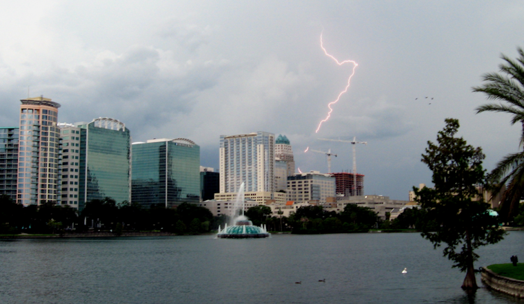
Central Florida residents, brace yourselves for an oncoming deluge as deep moisture moves over the area, bringing substantial rain and storms. The National Weather Service in Melbourne FL, has highlighted above-normal lightning storm chances and locally heavy rainfall as the primary impacts for today and into the night.
The forecast discussion indicates a 40% chance of a tropical depression forming within the next couple of days, which would then track across the peninsula before reaching the northeast Gulf by Wednesday. Despite infrequent breaks in precipitation, the prediction remains for widespread coverage of showers and storms (~80-90%), with possible local totals reaching up to 4.5 inches. Even with a high possibility of rain, the temperatures in central Florida are not spared from the heat, remaining muggy with highs in the mid-to-upper 80s.
As Wednesday approaches, Floridians won't see much relief. The low-pressure system is expected to change its venue into the northeastern Gulf, with rain chances between 70-80 percent remaining steady. The typical sunshine might peek through the decreasing cloud cover on Wednesday, but with it comes the caveat of fueling an isolated storm threat, as indicated by the National Weather Service. Despite the looming wet pattern each day, there is a slight pivot towards normalcy on the temperature spectrum, with highs managing to edge into the upper 80s to low 90s.
Looking ahead to the weekend, a semblance of the regular Floridian summer is anticipated to return. Forecasts suggest a more summerlike pattern of scattered afternoon showers and storms, courtesy of the sea breeze circulation. Still, the heat marches on, with high temperatures set to bounce into the low to mid-90s, and heat index values possibly hitting a sweltering range of 100-106 degrees. In maritime concerns, increased winds of up to 15-20 kts could prompt small craft to exercise caution tonight and into Wednesday, even as the turbulent weather persists through Thursday and eases by the end of the week.
Aviators should be especially cautious as this low pressure makes its presence known. The aviation forecast alerts to unsettled conditions and advises aircraft operators of the prevailing IFR CIGs, as well as a higher-than-normal threat of showers with embedded lightning storms, which could impact flights with gusty winds, heavy downpours, and dangerous lightning strikes.


