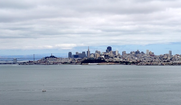
San Francisco’s weather keeps on its steady course this coming week, folks. Cloudy mornings are forecasted to part, giving way to clearer afternoons, with that familiar chill as breezy onshore winds pick up each evening. According to the National Weather Service in San Francisco, there's also a bit more action on the horizon with a boundary passing through, expected to stir up stronger gusts on Sunday and Monday, particularly along the coast and through those notorious wind tunnels in mountain passes and the Salinas Valley. Temperatures are holding steady, hovering near or just below the norm, so expect highs mainly in the 70s to 80s inland, and cooler temps by the bays and coast.
Details from a NWS San Francisco update paint a typical Bay Area picture: the "deep marine layer" is serving up what we know as coastal drizzle in the a.m., so don’t forget to grab a light jacket on your way out in the mornings. By Sunday afternoon, get ready to watch things turn gusty as a weak upper low-pressure system swings by to the north of us.
The outlook for midweek is looking up with a "quieter weather" pattern, as mentioned in the Area Forecast Discussion by the National Weather Service. There might be a subtle tendency to warm back up by a few degrees, but don’t expect to shed too many layers.
Turning our gaze upwards, the aviation outlook is a "mixed bag of LIFR-VFR at the terminals" with that persistent marine layer hanging at about 1,400 feet. However, high confidence stands on VFR by afternoon, and for those of you sky-gazing or flying out of SFO, expect the low stratus clouds to linger by the coast. For boaters and mariners, take note: there's a Small Craft Advisory in effect. "Fresh to strong northwesterly breezes" are set to bring "near-gale to gale force gusts on Sunday and Monday," so be sure to exert caution out on the open water, especially if you're venturing out past the bay, as per the NWS San Francisco.


.jpg)