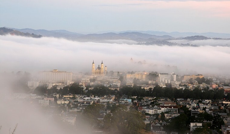
San Francisco's typical foggy embrace is set to linger, as a 2000-foot marine layer has enveloped the coast and inland valleys. According to a forecast issued by the National Weather Service for San Francisco this morning, stratus clouds are expected to recede to the coastline by late morning, leading to mostly sunny skies across the area amidst normal seasonal temperatures. "Expect the associated stratus to retreat to the coastline by late morning/early afternoon for most locations, under mostly sunny skies area wide," the statement elaborated, indicating a tranquil pattern for the city and its surrounding neighborhoods.
The outlook through the weekend promises quiet weather and low chances for elevated convection, as no significant disturbance appears to be on the radar to disrupt the calm. Locals can anticipate typical August conditions, with an extended forecast featuring temperatures that dance near the expected norms. Despite mid-level moisture over the region, "not expecting any elevated convection to develop this afternoon or evening," the National Weather Service pointed out, mainly due to an absence of a lifting mechanism that could stir up the skies.
Looking ahead to the end of the week, slight warmth is on the horizon, courtesy of a subtle transition toward shortwave ridging that should deliver a marginally warmer weekend than what's been felt lately. However, the comfort of warmer rays will be short-lived. According to the forecast, "The weak ridging pattern over the weekend will give way to more persistent troughing over the eastern Pacific for the remainder of the extended forecast," which implies cooler temperatures will roll in as the next week unfurls, marking a shift to more autumnal feels.
Maritime conditions are equally subdued, offering a welcome steadiness for those taking to the seas. The local marine forecast confirms "gentle to moderate breezes and moderate seas persist across the majority of the coastal waters through the week." Mariners navigating the far northern outer waters should be prepared for potentially stronger gusts and rougher seas, though these conditions are par for the course along this typically turbulent stretch. "Locally moderate to fresh gusts and rough seas are expected across the far northern outer waters," the National Weather Service cautions.
Regarding aviation, the stratus layer is causing some visibility issues, with the SFO-SAC pressure gradient indicating potential for inland movement of fog. The impact on flights is expected to be minimal, with the stratus set to clear back to the coastline during the day, making way for VFR conditions in most regions inland. "Stratus/MVFR-LIFR/ will mix out back to the coastline today, then move back inland tonight and Wednesday morning," is the outlook for air travelers per NWS.


