Trade winds, a familiar and welcome presence in Hawaii, are making their comeback today, bringing with them a reduction in humidity and a forecast of drier conditions that are expected to last through Saturday, according to the National Weather Service Honolulu Forecast Office. Locals and visitors alike can anticipate brief showers over windward mountain areas during this period, but overall, less moisture in the air and subsidence inversion will mean minimal rainfall across the islands.
In addition to the return of the trade winds, the forecast mentions that Tropical Storm Henriette is projected to drift westward, narrowly passing north of Hawaii from Sunday to Monday. This weather system is expected to meddle with the prevailing trade winds, leading to an uptick in shower activity, especially over the leeward and interior sections of the islands. Notably, and expect very warm and humid conditions to linger into early next week.
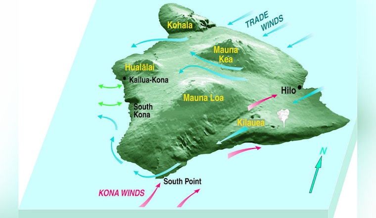
Focusing on the more immediate local concerns, the recent eruption from Kilauea has generated volcanic smog, known as VOG, which has been detected by air quality sensors, particularly along the southern and Kona slopes of the Big Island. With trades making a comeback, VOG concentrations should largely be kept at bay from the smaller islands through Saturday. However, a shift in winds could bring this VOG plume northward into the smaller islands by Sunday if volcanic emissions continue.
The marine forecast is advising sailors and water enthusiasts to brace for strengthening trade winds today, which have triggered a Small Craft Advisory effective through late tonight across certain areas prone to gustier conditions. According to the forecast, weekend trades are likely to weaken as Tropical Storm Henriette approaches, but a resurgence of moderate trade winds is on the horizon for late Monday onward. On the swell front, south-facing beaches should prepare for High Surf Advisory levels by Friday, with the potential for conditions to escalate to High Surf Warning thresholds by Saturday.
Fire weather conditions are expected to improve through Saturday as trade winds return and humidity decreases. However, tropical moisture associated with Tropical Storm Henriette may spread across the islands from Sunday to Monday, potentially affecting fire conditions. More stable weather is forecast to return by mid-week.
The advisories currently in place include a Small Craft Advisory affecting areas such as Maalaea Bay, Pailolo Channel, Alenuihaha Channel, Big Island Leeward Waters, and Big Island Southeast Waters, which is set to remain in effect until 6 AM HST Friday. Residents and visitors are encouraged to remain aware of the evolving weather conditions, particularly as Tropical Storm Henriette approaches, and to adhere to all local guidance and advisories for safety.


