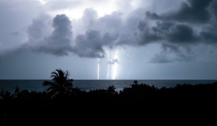
Hawaii residents are enjoying a brief respite from humid conditions this week, but relief will be short-lived as Tropical Storm Henriette approaches from the east. The storm is expected to bring muggy weather back to the islands this weekend, marking the second wave of tropical moisture to affect Hawaii in recent days.
As of early Thursday morning, Hawaii Tribune-Herald reported Henriette's center was located about 1,462 miles east of Honolulu. The storm was moving west at 16 mph with maximum sustained winds of 50 mph, according to the National Hurricane Center.
Trade winds are making their comeback Thursday, bringing reduced humidity and drier conditions expected to last through Saturday. According to Honolulu Star-Advertiser, the National Weather Service in Honolulu said the high-pressure ridge north of the state will weaken over the next several days. This pattern will allow tropical moisture to spread across the islands, creating the familiar muggy conditions that characterize Hawaii's hurricane season.
Double Impact from Gil and Henriette
The weekend's humid conditions represent the second wave of tropical moisture to affect the islands recently. Yahoo News noted that remnants of former Tropical Cyclone Gil passed just north of the islands Wednesday and Thursday, bringing warm, humid conditions and increased showers. The pattern creates a weather sandwich of sorts, with brief trade wind relief bookended by tropical moisture.
Henriette is forecast to make a gradual turn toward the northwest by Saturday, as The Garden Island explained this occurs "in response to a mid-latitude, mid-level trough moving toward the Hawaiian islands from the north-central Pacific." The storm's center will remain well north of Hawaii while still affecting local weather patterns.
What to Expect This Weekend
As reported by Honolulu Star-Advertiser, the National Weather Service said Henriette will pass just north of the islands Sunday into Monday. This passage will produce lighter hybrid sea breeze and trade wind conditions along with very warm and humid weather that residents know all too well.
The storm's approach will weaken trade winds, bringing what forecasters describe as "a period of muggy conditions for the weekend." However, relief is on the horizon, with moderate trade winds expected to return by late Monday afternoon, offering the predictable pattern of discomfort followed by relief that defines island life during hurricane season.
Hurricane Preparedness Reminder
Hawaii County Civil Defense officials are using Henriette's approach as a timely reminder about hurricane preparedness. "We had a conference with the National Weather Service on Monday," Bill Hanson, an administrative officer for Hawaii County Civil Defense, told West Hawaii Today. He noted they're expecting "wetter but humid conditions at the end of the week."
Hanson emphasized the timing's significance: "It's also worth noting that we're heading into the peak of our hurricane season. This is a good reminder that if you don't have a preparedness plan or a hurricane kit or things like that, you should have that." The official noted that last week's red flag warning conditions across the state should be alleviated by the incoming moisture.
For mariners and water enthusiasts, strengthening trade winds Thursday have triggered Small Craft Advisories in areas prone to gustier conditions. Fire weather conditions are expected to improve through Saturday as trade winds return and humidity decreases, though the tropical moisture from Sunday to Monday may affect fire conditions once again.


