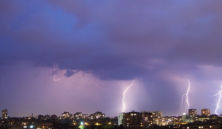
Residents in the Central Valley and parts of the East Bay were met with an atmospheric spectacle this morning as "dry" thunderstorms passed through the region. According to a National Weather Service San Francisco CA forecast, there was a 15-20% chance of isolated showers and thunderstorms primarily along the interior eastern portions of Contra Costa, Alameda, Santa Clara, San Benito, and Monterey counties.
While some areas recorded less than 0.10 inches of rain, the electrical storm activity was intense. In a social media post by NWSBayArea, an image highlighted approximately 5,000 lightning strikes, both cloud to ground and in-cloud, before 5:30 AM. The storms, running up against an upper-level low inching toward the coast and monsoonal moisture surging northward across California, led to this rare weather event.
"Dry" thunderstorms rolled through the Central Valley and portions of the East Bay this morning. Most areas saw less than 0.10" inches of rain & there were a few fire starts. Here's an image showing ~5,000 lightning strikes (cloud to ground and in-cloud) through 530am. #CAwx pic.twitter.com/uvtzRsaxez
— NWS Bay Area 🌉 (@NWSBayArea) September 2, 2025
The phenomenon has not been without consequence. Bay Area officials were on alert, as the NWS warned of "a low, 15-20%, chance of high impact weather if any elevated showers, isolated dry lightning and storm associated gusty outflow winds develop." The potential hazards were serious, including sporadic fire starts in some regions.
In the wake of these storms, a gradual cooling trend is expected to kick in through the rest of the week, leading temperatures to hover closer to normal for early September. Alongside the cooling, residents can expect the marine layer to deepen, leading to stratus clouds each evening that will spread inland overnight, easing the fears of prolonged dry conditions post-thunderstorms.
The rest of the week looks to maintain the cooler, more serene weather pattern. While above-average precipitation for this time of year usually doesn't add up to much and may manifest merely as coastal drizzle or light rain, widespread rainfall is not anticipated, according to the NWS forecast.


_(by-sa).jpg)