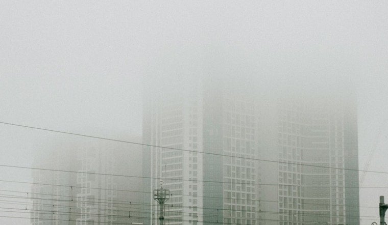
Residents of Minneapolis and surrounding areas woke up to a shroud of dense fog that reduced visibility significantly this morning. According to the National Weather Service's forecast for Minneapolis, the thick fog primarily persisted before 9:00 a.m., but drivers were advised to exercise caution. Later today, the skies are expected to clear, giving way to partly sunny conditions with a high near 76 degrees.
Tonight, the fog is expected to make a comeback after 3:00 a.m., leading into a mostly clear night with lows dropping down to around 57 degrees. The calm, easterly wind around 5 mph has been noted for the evening, which may contribute to the formation of patchy fog. Thursday will see generally sunny skies once any lingering morning fog has burned off, moving towards a comfortable high near 77 degrees.
Consistent with the weather pattern, this weekend in Minneapolis presents partly sunny days with highs in the mid-80s, and slight chances of showers and thunderstorms during Sunday night into early next week. As stated in the weather forecast, the southeast wind picking up to around 5 to 10 mph will likely not disrupt plans much, but it’s worth keeping an umbrella nearby for the occasional drizzle.
Regarding the fog conditions, the National Weather Service issued a Dense Fog Advisory, which remained in effect until 9:00 A.M. CDT. The advisory outlined visibility of one-quarter mile or less in dense fog. Areas affected by the fog included central, east central, south central, southeast, southwest, as well as west central Minnesota and parts of northwest and west central Wisconsin. Drivers were recommended to slow down, use their headlights, and leave plenty of distance ahead of them to ensure safety during reduced visibility conditions.


