As the Hawaiian Islands brace for increased shower activity, a low pressure system north of the region has been making its slow southward journey. According to the National Weather Service in Honolulu, this weather pattern is set to bring a notch up in rainfall, particularly to Niihau, Kauai, and sections of Oahu through tomorrow, with Kauai at the heart of the heaviest showers and potential for isolated thunderstorms.
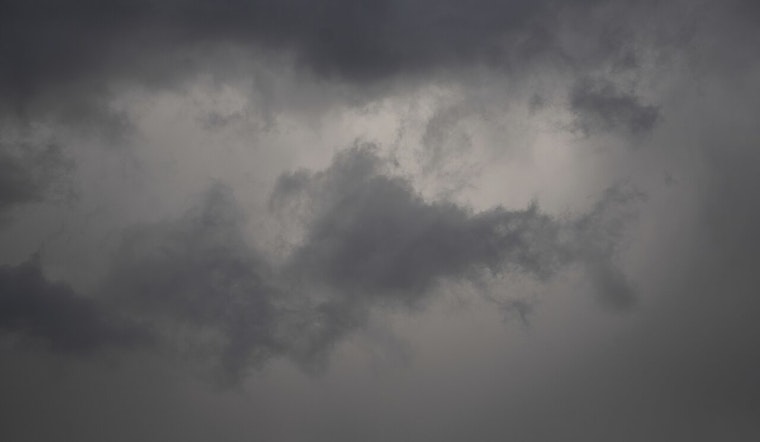
The NWS’s latest satellite imagery shows a cold front moving southwestward, signaling the arrival of colder air aloft and a more unstable atmosphere. As reported by the NWS, the heaviest showers will be confined to the northern portion of the state, affecting areas such as Niihau, Kauai, and parts of Oahu today and into early tomorrow. Light southerly winds are expected to mix with afternoon sea breezes, producing additional cloud cover and showers across island interiors.
Gazing further ahead, the frontal system is anticipated to dissolve into a trough. Present models indicate a spread of shower activity by late Friday, yet the persisting gentler winds in the region will continue fostering localized sea breezes in the afternoon, capable of triggering showers across the interiors of all islands. Not to be outdone, the Big Island is on the watch for enhanced shower activity and thunderstorms on Friday and Saturday, linked to incoming unstable tropical moisture.
As we pivot into the weekend, expect a gradual shift in conditions. "Winds will back into a more easterly direction, reintroducing stable trades and associated showers to the forecast," as stated by the NWS. This transition marks the return of moderate to locally brisk trade winds and showers that will play favorites, tending towards windward and mauka areas during the early hours.
In aviation news, Hawai'i's skies are set to continue their variable windy state, with the anticipation of MVFR conditions due to increased showers, especially around PHLI, PHNL, and PHJR. Mariners are also advised to expect light winds until trade winds make their comeback by Sunday, courtesy of a high pressure ridge moving in.
Lastly, for all land folks concerned about fire weather conditions, increased humidity and lighter winds are keeping fire risks at bay through the weekend. This weather idyll is projected to shift as trades strengthen and bring drier conditions next week.


