Residents in Orlando and surrounding areas are prepping for another few days of relentless rain and potential minor flooding, as forecasted by the National Weather Service Melbourne FL. According to the latest advisory, the weather patterns holding sway over the region aren't looking to budge before mid-week. The existing front and a significant glut of moisture in the atmosphere are expected to sustain a high probability of showers and thunderstorms, with an 80 percent chance mentioned for the next couple of days.
The situation, while dampening spirits, isn't out of the blue for this time of the year. With atmospheric water levels (PWATs) reaching between 2.00 and 2.40 inches, it's no wonder forecasters are predicting daily downpours that could accumulate 2-4 inches, leading to minor disruptions in the form of "nuisance flooding." As much as the saturated sky promises to pepper the pavement, temperatures will hover near to slightly below the norm, primarily registering mid to upper 80s, reported by the National Weather Service Melbourne FL.
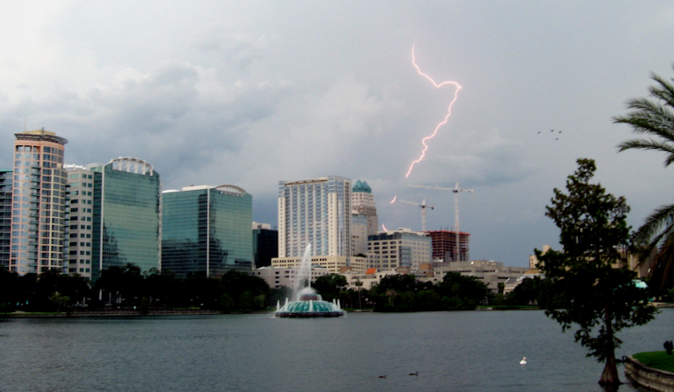
These wet conditions are unfortunately paired with a Marginal Risk for excessive rainfall each day, igniting concerns for the strongest storms to manifest occasional to frequent lightning strikes and gusty winds up to around 45 mph.
For beachgoers, the forecast puts a damper on any surfside plans. A building northeast swell is contributing to dangerous, potentially life-threatening rip currents, particularly affecting the Volusia, Brevard, and Indian River coasts. The advisory cautions strongly against entering the surf through at least mid-week, for the surf will be rough, and the risks—increased. Despite the tempestuous times, the National Weather Service Melbourne FL reassures that a semblance of reprieve is on the horizon: an upper trough sliding down across the Eastern CONUS is set to usher in drier air with lowering precipitation chances late Friday and into the weekend.


