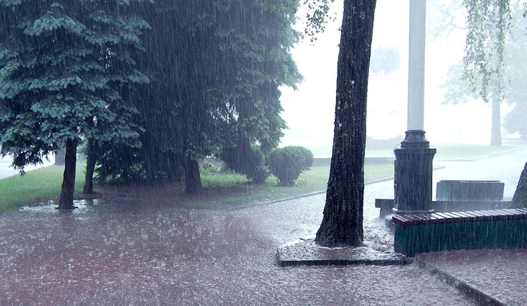
Honolulu residents, it's time to keep your raincoats handy as the coming days forecast a blend of showers and possibly heavier bouts of rain peppered with an ever-so-slight chance of thunderstorms, especially if you're hanging out near Kauai or Niihau. An upper level low, currently located a good 300 miles west, is expected to shimmy over to the northeast by tonight and morph into a trough, which will take up a near-stationary position and lead to increased instability in the region. In layman's terms: expect scattered showers and brace for potential thunderstorms offshore.
According to the National Weather Service's Honolulu forecast, while the cloud shield is casting a shroud over the entire state, the islands of Kauai and Oahu are on the receiving end of the brunt of these showers, with windward and mauka locales not far behind. The weather patterns are throwing hints of a closed low soon pushing southwest of Hawaii, further stirred into activity by an upper ridge. Despite the uncertainties clouding the forecasting models about this system's evolution, the one thing that meteorologists seem certain about is that the trade wind pattern isn't going anywhere for now, favoring windward and mauka showers, with a few making a cameo on the leeward sides too.
On the aviation front, pilots can expect a gradual ease in the breezy trade winds with the advent of the week as the high pressure from a distant front starts losing its grip. While most showers are likely to cuddle up to windward and mountain areas, don't be surprised at a brief, rogue light shower elsewhere. Due to increased humidity, low ceilings are a possibility amidst heavier showers, so keep your eyes peeled for MVFR conditions; otherwise, it's mostly clear skies. A friendly heads-up to aviators: be wary of light icing between 140 and FL210, with an AIRMET Zulu in effect, which might upscale to moderate icing at times. And if you're cruising between FL250 and FL380, there's a temporary AIRMET Tango for moderate upper-level turbulence to deal with.
Surfers might get excited about the moderate uptick in north shore surf, thanks to a north-northwest swell that's planning to crest this afternoon before tapering off tomorrow. While Wednesday promises to throw a bone with a modest short-period bump in the surf, the caveat: the storm churning out these swells is a bit of a fast-mover, which translates to a murky forecast for surf heights. However, keep your boards waxed for the weekend when a fresh northwest swell could push surf heights into advisory territory, making for some gnarly waves on exposed north and west shores. The east shore isn't expecting much fanfare, with only a moderate surf powered by ebbing trades, although a bite of the north swell could boost things up mid-week.
For those worried about fire weather conditions, you can breathe easy. The forecasted high-level moisture is sufficient to keep the relative humidity (RH) levels from dropping into the critical zone. Even with the lighter trade winds, temperature inversions are expected to hover in the 6,500 to 7,500 feet range, which isn’t exactly cause for alarm. As of now, there are no fire weather advisories in effect, signaling a somewhat damp yet stable period for the islands.


