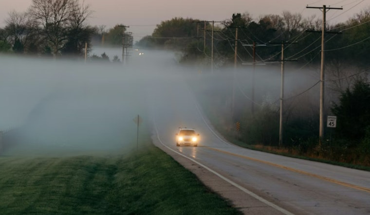
Residents across a portion of Middle Tennessee may need to budget in some extra time for their morning commute as fog blankets the region. The National Weather Service in Nashville has issued a Dense Fog Advisory effective until 9 AM CST this morning, warning of visibility dropping below one mile in some areas. Areas covered by the advisory include major cities like Nashville, Clarksville, and Murfreesboro.
The fog is part of a wider pattern of unsettled weather hitting the region, including chances of showers and thunderstorms expected later in the day through the week ahead, the forecast suggests rain is nearly a certainty, with Thursday seeing a 100% chance and new rainfall amounts ranging from a half to three quarters of an inch, patchy fog will also persist in these conditions, possibly impacting travel and outdoor activities. According to the detailed weather forecast, the incoming systems could bring substantial rainfall through the weekend and into early next week, with the highest temperatures reaching the low to mid-seventies.
The NWS cautions that low visibility could make driving conditions hazardous, and drivers are advised to slow down, use headlights, and maintain a safe following distance from other vehicles. The series of weather-related advisories and predictions is part of the ongoing efforts by the National Weather Service to ensure public safety and preparedness in circumstances where weather patterns can cause disruptions and pose risks to travelers and residents alike.
As for the weekend outlook, after the showers taper off by Saturday noon, a 20 percent chance still exists; folks might catch a brief reprieve with mostly cloudy skies and a high near 68, but don't get too comfy—the weather plans a comeback with patchy fog after 11pm signaling another round of potentially soggy conditions.


