Residents of Chicago are currently navigating a patchwork of weather conditions, marked by the clearing of previous snowfall, which brought a range of accumulation from a half inch to 2 inches in different parts of the city. As reported by FOX32 Chicago, a treacherous freezing fog has descended upon the city, causing particularly slick roads for morning commuters, especially on surfaces that have yet to receive treatment.
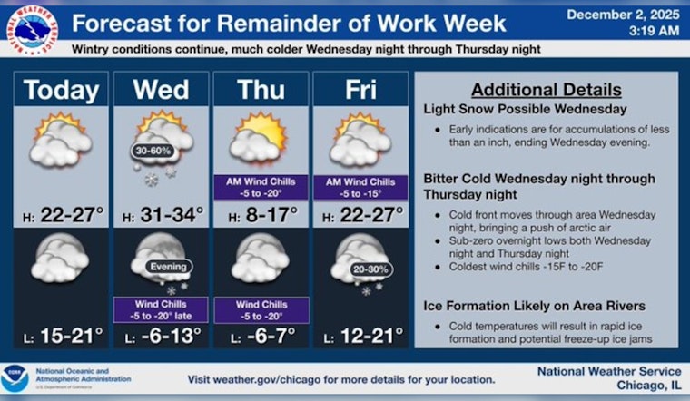
The unforgiving grip of the cold continues to hold, with brief moments where the sun peeks through the overcast sky. Highs are expected to scarcely crawl into the mid-20s. According to the National Weather Service, the remainder of the week appears to relent just slightly, as the potential for significant snowfall tomorrow now seems unlikely, though a small flurry could still brush past the cityscape. Highs inching toward the freezing mark give cold comfort to those bracing for the next bout of frigid air projected for Thursday, where morning lows are forecast to hover barely above zero degrees with middling highs only reaching the mid-teens.
As the weekend approaches, forecasts indicate a continuation of the dour cloud cover and persistent cold, with temperatures anticipated to peak in the upper 20s. Another round of minor snowfall could make an appearance Saturday night into Sunday. These predictions are bolstered by the detailed outlook available from the National Weather Service, which also emphasizes a gradual warming on Friday alongside a possibility of snow in the evening.
Chicago's winter spell, with its combination of sporadic sunshine and potential snow flurries, emphasizes the unpredictability of this season's weather patterns.


