The National Weather Service in Wilmington issued updates for weather conditions affecting areas around Columbus, Cincinnati, and beyond — an area not unfamiliar with the whims of midwestern weather patterns. The latest forecast indicates that after tonight's upper-level disturbance clears, the Midwesterners are in for a stretch of northwest flow, with surface high-pressure tilting all the way southeast from somewhere over North Dakota/Minnesota (NoDak/MN) through Sunday.
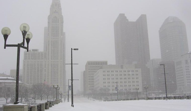
Particularly for early risers on Wednesday, Columbus and its environs saw a smattering of freezing drizzle leading to several traffic incidents, as reported by the National Weather Service. Adding to the chill, the forecast hits a stark note with "temps rise to the low 30s, but will be offset by west wind 15-20 mph creating wind chills in the teens to low 20s." Be prepped for more than just a brisk walk to your car — it's the kind of cold that makes you reconsider your choices.
On Thursday's slate is another bout of weather action — snow arcing above the I-70 corridor by evening, probably hitchhiking southward at nightfall. The accumulation looks to favor central Ohio, particularly along and north of the interstate. It seems the snowfall won't be a slow dance but more like a quickstep — "the bulk of accumulating snow in a short 1-maybe 2 hour time frame," as highlighted in the NWS discussion. With temperatures slated to drop further into the low teens up along I-70, it’s a cold reminder of winter's lingering tenure.
Looking ahead, the forecast doesn't offer much fluctuation for Ohio Valley residents. The weekend may see temperatures nudging up, climbing into the upper 30s in the north and upper 40s in northern Kentucky — a modest thaw that should give residents a sliver of reprieve from the frosty grip of late-year chills. Sunday will begin to see the western ridge over the U.S. amplify, and "temps rise back into the upper 30s north/upper 40s in nrn KY for both Sun and Mon," the NWS report states.
For those taking to the skies, airport conditions will reflect the ground's whims with CVG/LUK facing MVFR (Marginal Visual Flight Rules) tagging alongside possible VFR (Visual Flight Rules) this morning. Meanwhile, "Winds will be gusty," the NWS notes, which could signal further turbulence not just for flights but road conditions as sustained wind speeds tick up through the night.
The message is clear: Ohioans should brace for wintry bouts, swift snowfalls, and keep that thick coat handy. While the high-pressure system might promise stability, the heartland knows better than to trust in the weather's steadiness. Eyes on the sky and hands at the ready, the forecast enforces preparedness as the key to weathering this seasonal rollercoaster.


