Honolulu has been grappling with heavy rainfall as the remnants of a cold front bring moisture-rich air across the Hawaiian Islands. The National Weather Service (NWS) in Honolulu reports that while the front is weakening, its transition to a trough is causing showers and possible isolated storms, particularly over Kauai and Oahu. According to the NWS's latest forecast, rain chances should begin to decrease for Oahu by the middle of the week, but remain relatively high for Niihau and Kauai due to the proximity of a stationary boundary off the western coast.
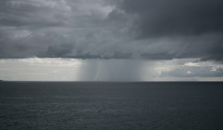
Kauai and Oahu saw another round of heavy rain overnight, with many locations picking up 1 to 2 inches since late Sunday evening. A Flood Watch remains in effect through early Tuesday as saturated ground could lead to minor flooding in low-lying areas. Another cold front approaching Kauai may bring additional rain and thunderstorms as it merges with the existing trough.
In terms of aviation, the trough lingering near Kauai and Oahu will persist, bringing with it periods of IFR/MVFR ceilings and visibility within heavier showers. AIRMET Sierra is in effect for these areas, signaling that mountain obscuration and IFR conditions are imminent. Travelers are advised to expect variable winds that will eventually settle into a southerly direction as the trough finishes its course.
The surface trough continues to bring unsettled conditions with showers and isolated thunderstorms, mainly in Kauai Coastal Waters. A Small Craft Advisory is in effect until this evening for most coastal areas around Kauai and Oahu due to high seas from a north-northwest swell. Large swells from 320–340° will peak today and gradually decline into Tuesday, with surf remaining at High Surf Advisory levels for exposed north and west shores.
Fire risks remain below critical levels due to heavy rainfall. The trough between Kauai and Oahu maintains unsettled weather with light to moderate southerly winds, while Maui and the Big Island see more stable conditions. Temperature inversions are expected between 7,000–9,000 feet, keeping the fire weather outlook low.


